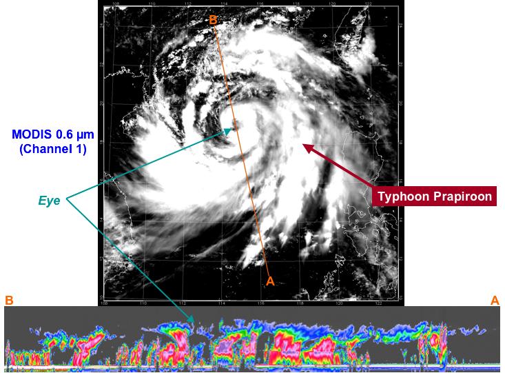
At approximately 0553 UTC (1:53 am EDT), on 2 Aug 2006, CloudSat flew over the eye of Typhoon Prapiroon as it approached southern China.
The upper image is from the MODIS instrument on the NASA Aqua satellite, to give an idea of how the storm looked from the top. The bottom image is from NASA's new CloudSat satellite. The CloudSat radar flies in an on-orbit formation with the Aqua satellite, approximately one minute behind, as part of the A-Train constellation of satellites.
The red and purple areas indicate large amounts of cloud water. The blue areas along the top of the clouds indicates cloud ice, while the wavy blue lines on the bottom of the image indicate intense rainfall. Notice that the solid line along the bottom of the panel, which is the ground or ocean surface, disappears in many of these areas of intense precipitation. It is likely that in these areas the precipitation rate exceeds 30mm/hr (1.18 inches/hour) based on previous studies.
The CloudSat radar data will be processed to estimate the total amount of water and ice contained in this typhoon.
Quicklook Images can viewed at the CloudSat Data Processing Center.
