PIA08469: Into the Void
Target Name: Mars
Is a satellite of: Sol (our sun)
Mission: Mars Global Surveyor (MGS)
Spacecraft: Mars Global Surveyor Orbiter
Instrument: Mars Orbiter Camera (MOC)
Product Size: 1024 x 1512 pixels (width x height)
Produced By: Malin Space Science Systems
Producer ID: MOC2-1465
Full-Res TIFF: PIA08469.tif (1.55 MB)
Full-Res JPEG: PIA08469.jpg (205.8 kB)

Click on the image above to download a moderately sized image in JPEG format (possibly reduced in size from original)

Original Caption Released with Image:

17 May 2006
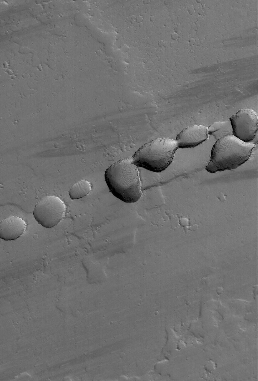
This Mars Global Surveyor (MGS) Mars Orbiter Camera (MOC) image shows a portion of a chain of pits on a lava- and dust-covered plain northwest of Tharsis Tholus -- one of the many volcanic constructs in the Tharsis region of Mars. Pit chains, such as this one, are associated with the collapse of surface materials into subsurface voids formed by faulting and expansion -- or extension -- of the bedrock.

Location near: 16.4°N, 92.6°W
Image width: ~3 km (~1.9 mi)
Illumination from: lower left
Season: Northern Winter

Image Credit:
NASA/JPL/Malin Space Science Systems

Image Addition Date:
2006-05-17