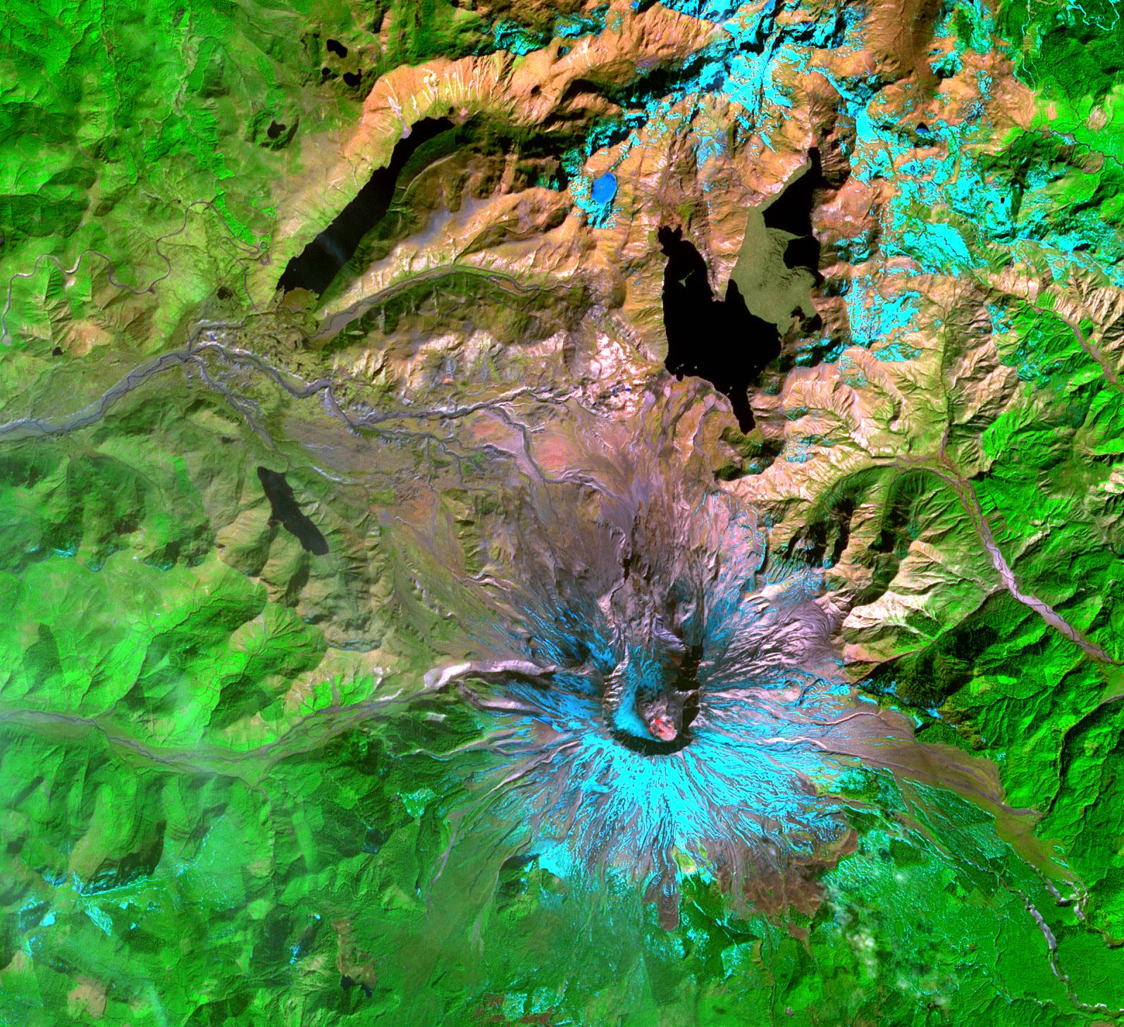
This Advanced Spaceborne Thermal Emission and Reflection Radiometer (ASTER) image of Mount St. Helens was captured one week after the March 8, 2005, ash and steam eruption, the latest activity since the volcano's reawakening in September 2004. The new lava dome in the southeast part of the crater is clearly visible, highlighted by red areas where ASTER's infrared channels detected hot spots from incandescent lava. The new lava dome is 155 meters (500 feet) higher than the old lava dome, and still growing.
With its 14 spectral bands from the visible to the thermal infrared wavelength region, and its high spatial resolution of 15 to 90 meters (about 50 to 300 feet), ASTER images Earth to map and monitor the changing surface of our planet.
ASTER is one of five Earth-observing instruments launched December 18, 1999, on NASA's Terra satellite. The instrument was built by Japan's Ministry of Economy, Trade and Industry. A joint U.S./Japan science team is responsible for validation and calibration of the instrument and the data products.
The broad spectral coverage and high spectral resolution of ASTER provides scientists in numerous disciplines with critical information for surface mapping, and monitoring of dynamic conditions and temporal change. Example applications are: monitoring glacial advances and retreats; monitoring potentially active volcanoes; identifying crop stress; determining cloud morphology and physical properties; wetlands evaluation; thermal pollution monitoring; coral reef degradation; surface temperature mapping of soils and geology; and measuring surface heat balance.
The U.S. science team is located at NASA's Jet Propulsion Laboratory, Pasadena, Calif. The Terra mission is part of NASA's Science Mission Directorate.
Size: 21.9 by 24.4 kilometers (13.6 by 15.1 miles)
Location: 46.2 degrees North latitude, 122.2 degrees West longitude
Orientation: North at top
Image Data: ASTER bands 8, 3, and 1
Original Data Resolution: 15 meters (49.2 feet)
Dates Acquired: March 15, 2005
