- Original Caption Released with Image:
-
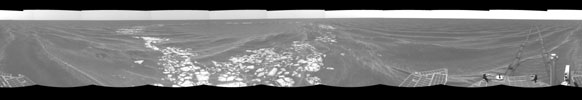
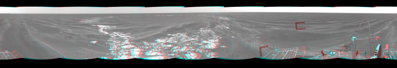
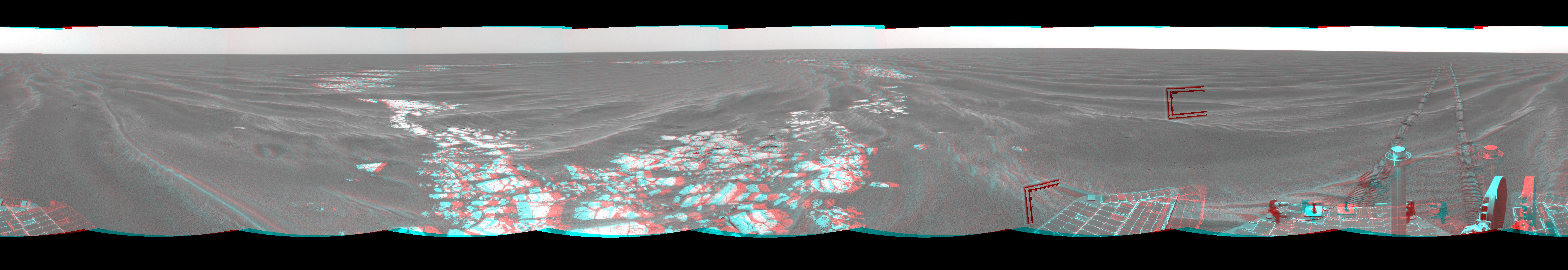
Figure 1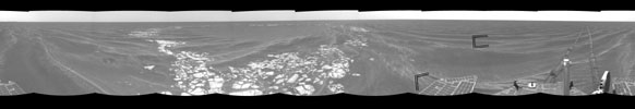
Figure 2NASA's Mars Exploration Rover Opportunity used its navigation camera to take the images combined into this 360-degree view of the rover's surroundings on the 399th martian day, or sol, of its surface mission (March 8, 2005). Opportunity drove 35 meters (115 feet) that sol and reached the edge of "Vostok Crater" before taking the images. Sand has buried much of the crater. This location is catalogued as Opportunity's site 50. This three-dimensional view is presented as a cylindrical-perspective projection with geometric and brightness seam correction. Two angular marks in the right half of the image are artifacts of image-compression data loss. Figure 1 is the left-eye view of a stereo pair and Figure 2 is the right-eye view of a stereo pair.
- Image Credit:
-
NASA/JPL
Image Addition Date: -
2005-03-17
|

