- Original Caption Released with Image:
-
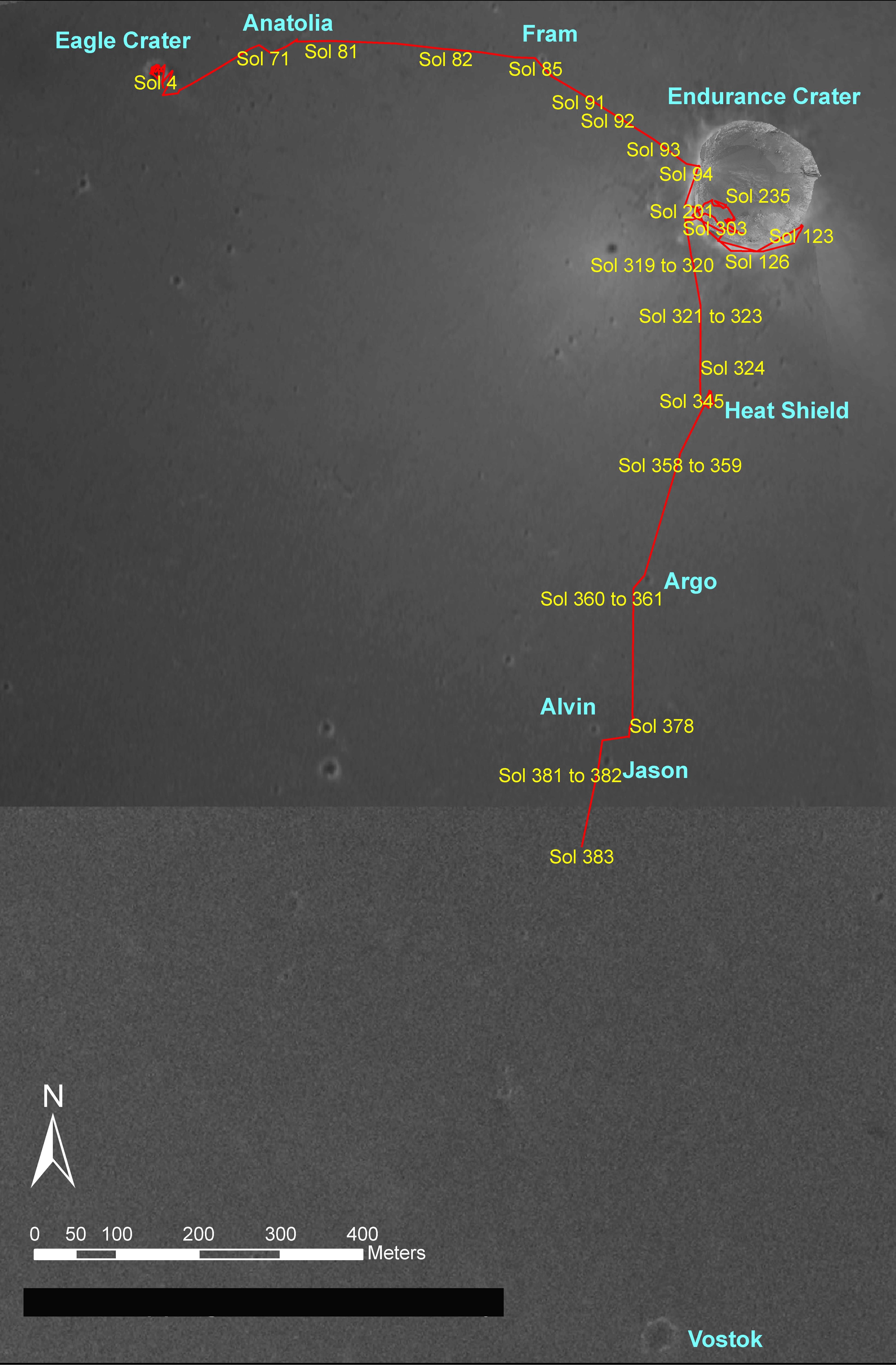
Figure 1NASA's Mars Exploration Rover Opportunity drove a total of 2,801 meters (1.74 miles) between its landing in January 2004 and its 383rd martian day, or sol (Feb. 20, 2005). This map on an image taken by the Mars Orbiter Camera on NASA's Mars Global Surveyor shows the course the rover drove during that period. Recently, Opportunity has been making rapid progress from "Endurance Crater" toward exploration targets farther south.
- Image Credit:
-
NASA/JPL/MSSS/OSU
Image Addition Date: -
2005-02-26
|

