- Original Caption Released with Image:
-
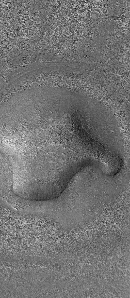
28 December 2004
This Mars Global Surveyor (MGS) Mars Orbiter Camera (MOC) image shows an eroded, rounded hill in the Deuteronilus Colles region of Mars, near 40.3°N, 338.8°W. The plains surrounding the hill have been pitted and modified by erosion. Similar pitting is common throughout the middle latitude regions of Mars. Some Mars science investigators have proposed that the pitted materials were ice-rich, and that sublimation of ice has created these textures. However, no similar landforms are found on Earth, thus there is no clear analog that would help scientists better understand the origin of these features. The picture covers an area about 3 km (1.9 mi) wide and is illuminated by sunlight from the left/lower left.
- Image Credit:
-
NASA/JPL/Malin Space Science Systems
Image Addition Date: -
2004-12-28
|
