- Original Caption Released with Image:
-
8 December 2004
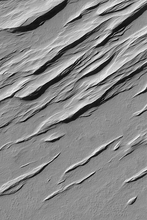
Yardangs are ridges formed by wind erosion. Most commonly, they will form in sedimentary rocks or volcanic ash deposits containing some amount of sand-sized grains (particles of 0.0625 to 2.0 millimeters size, like the grains in common table salt). This Mars Global Surveyor (MGS) Mars Orbiter Camera (MOC) image shows a suite of yardangs in the Memnonia Sulci region. The scene is located near 9.3°S, 172.4°W, and covers an area about 3 km (1.9 mi) wide. The ridges are illuminated by sunlight from the upper left.
- Image Credit:
-
NASA/JPL/Malin Space Science Systems
Image Addition Date: -
2004-12-08
|
