- Original Caption Released with Image:
-
17 November 2004
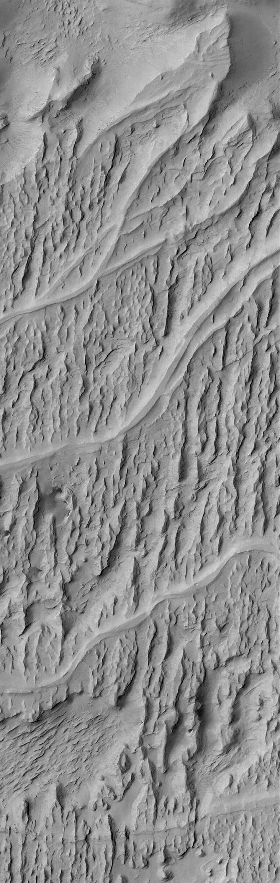
Mars was once a much wetter world than it is today. Locked within the martian bedrock are ancient channels and valleys through which liquids -- e.g., water -- once flowed. In the Aeolis region of Mars, wind erosion has exposed and inverted a plethora of ancient channels - stream beds -- in a fan-shaped sedimentary rock unit near 6.3°S, 208.6°W. This Mars Global Surveyor (MGS) Mars Orbiter Camera (MOC) image shows an example. The smooth-looking, sinuous ridges that run left-right across the image are the inverted channels. The rugged, sharp-looking ridges that run nearly north-south (up-down) through the image are yardangs--ridges formed by wind erosion. The water (or other liquid) responsible for the original channels flowed from the left (west) to right/upper right (east/northeast). This scene covers an area approximately 3 km (1.9 mi) across, and is illuminated by sunlight from the upper left.
- Image Credit:
-
NASA/JPL/Malin Space Science Systems
Image Addition Date: -
2004-11-17
|