- Original Caption Released with Image:
-
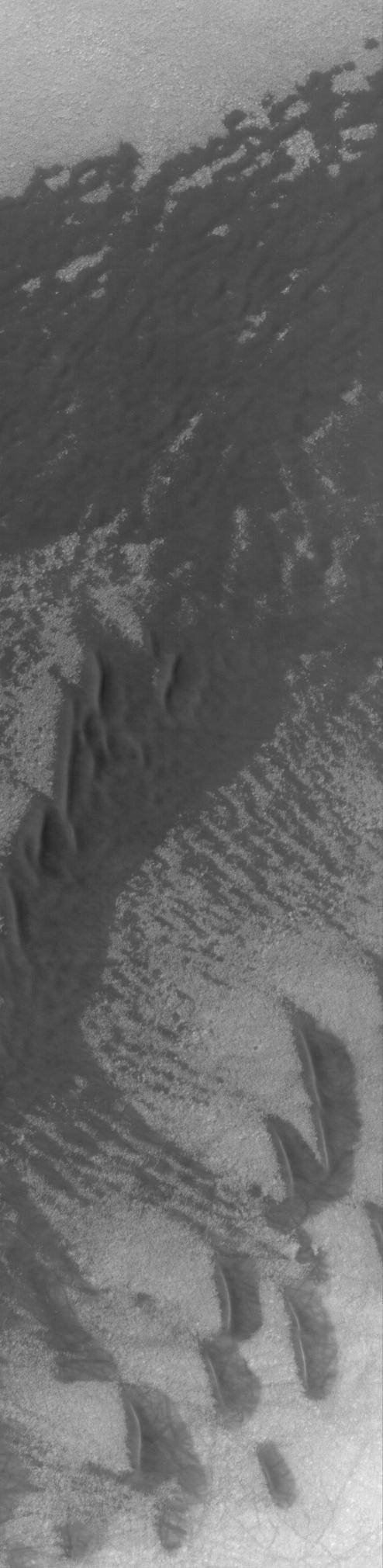
29 August 2004
Most southern high latitude dune fields occur on the floors of impact craters, and many of them are eroded into rounded or flattened forms. This Mars Global Surveyor (MGS) Mars Orbiter Camera (MOC) image shows a field of dunes (southern half of image) and a relatively flat sand sheet (northern half of image) in a crater located near 63.9°S, 95.9°W. Wind transport of sand was from the right toward left (east to west). Dark streaks superimposed on the dunes are the tracks made by passing dust devils. The image covers an area about 3 km (1.9 mi) across; sunlight illuminates the scene from the upper left.
- Image Credit:
-
NASA/JPL/Malin Space Science Systems
Image Addition Date: -
2004-08-29
|