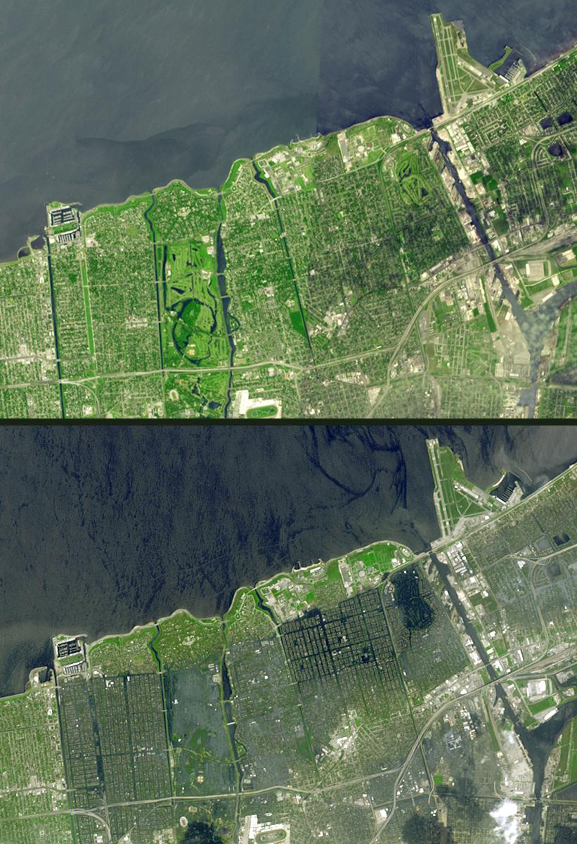
Seventeen days after Hurricane Katrina flooded New Orleans, much of the city is still under water. In this pair of images from the Advanced Spaceborne Thermal Emission and Reflection Radiometer on NASA's Terra satellite, the affected areas can clearly be seen. The top image mosaic was acquired in April and September 2000, and the bottom image was acquired September 13, 2005. The flooded parts of the city appear dark blue, such as the golf course in the northeast corner, where there is standing water. Areas that have dried out appear light blue gray, such as the city park in the left middle. On the left side of the image, the failed 17th street canal marks a sharp boundary between flooded city to the east, and dry land to the west.
The U.S. science team is located at NASA's Jet Propulsion Laboratory, Pasadena, Calif. The Terra mission is part of NASA's Science Mission Directorate.
Size: 10.4 by 7.1 kilometers
Location: 30 degrees North latitude, 90.1 degrees West longitude
Orientation: North at top
Image Data: ASTER bands 1, 2, and 3
Original Data Resolution: 15 meters (49.2 feet)
Dates Acquired: September 13, 2005
