- Updated Caption:
(View Original Caption)
-
Click on the image for Crater of Clues (QTVR)
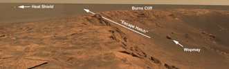
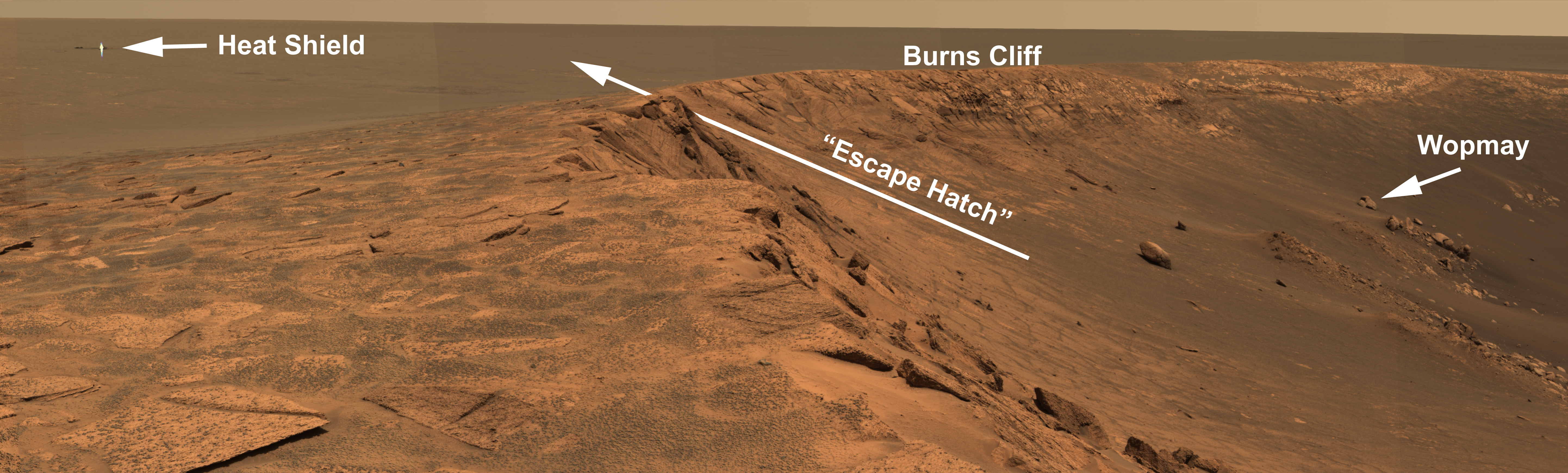
Figure 1
Opportunity Escape Plan
The labeled image (see figure 1) from the panoramic camera on NASA's
Mars Exploration Rover Opportunity shows the potential plan for
Opportunity's exit from "Endurance Crater." Opportunity may attempt
to leave Endurance via the route marked as the escape hatch, if
scientists and engineers consider it safe after taking a closer look.
Before leaving, however, scientists plan to investigate the rock to the
right dubbed "Wopmay," measuring 1 meter (3.3 feet) across, as well
as other rocks near "Burns Cliff." Scientists are interested in Wopmay
because its unusual texture is unlike any others observed so far at
Meridiani Planum. Once out of the crater, Opportunity may head to the
heat shield, indicated on the left. This image was taken on the rover's
249th martian day, or sol (Sept. 14, 2004). This is an approximate true-
color composite generated from the panoramic camera's 750-, 530-,
and 430-nanometer filters.
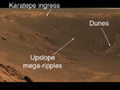
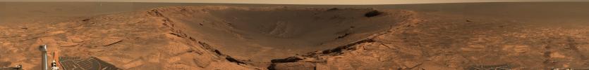
Figure 2
Trekking Down 'Endurance'
The panoramic camera on NASA's Mars Exploration Rover Opportunity
produced this approximate true-color mosaic image from a position at
the edge of "Endurance Crater." The image shows the "Karatepe"
ingress, where the rover began its traverse down into the crater on sol
159 (July 5, 2004). The rover is currently about 10 meters (32.8 feet) into
the crater. One of the major goals motivating the rover team to carefully
drive the rover further down into the crater is to follow up on clues observed
so far involving the element chlorine and the mineral pyroxene. The rover
has found that chlorine and pyroxene (a signature of basaltic, or volcanic,
rocks) increase in concentration with deepening layers of rock. Scientists
also hope to study the dunes, or "ripples," visible at the bottom right of this
image. These dunes show strong signatures for basalt and could further
develop the history of this area of Meridiani Planum.
- Image Credit:
-
NASA/JPL/Cornell
Image Addition Date: -
2004-06-16
|
