
Figure 1
A Hillside View, released June 2, 2004
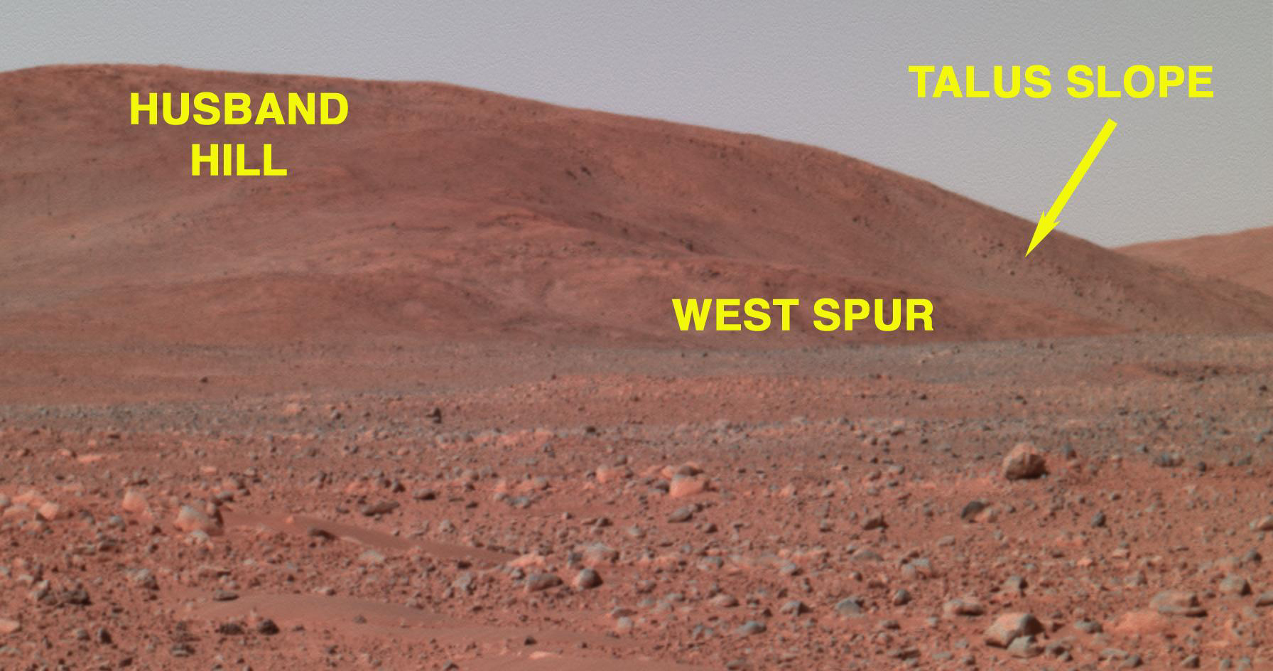
This image from the panoramic camera on NASA's Mars Exploration Rover Spirit shows a forward-looking view of a portion of the "Columbia Hills." This portion features "Husband Hill" to the left, "West Spur" in the center, and a talus (rock debris) slope to the right. West Spur is Spirit's planned first stop at the hills. Husband Hill measures approximately 90 meters (295 feet) tall from the base of the hills to its highest peak. Even in this distant shot, taken on sol 135 (May 20, 2004) from approximately 0.7 kilometers (0.4 miles) away from the base of the hills, large boulders can be seen on the hillside. These boulders are of great interest to scientists, as they may reveal clues about how these hills formed.
Based on these and past observations of the hills in comparison to hills on Earth and other celestial bodies, scientists theorize that the Columbia Hills may be one or a combination of the following: a portion of an eroded old crater rim, a wrinkle ridge, the remnants of a former interior crater deposit, a central peak or a volcano.
