- Original Caption Released with Image:
-
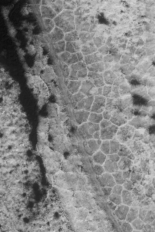
21 September 2004
This Mars Global Surveyor (MGS) Mars Orbiter Camera (MOC) image shows polygon patterned ground in the south polar region near 82.0°S, 90.8°W. Polygons are fairly common at high latitudes in both martian hemispheres, but they do not occur everywhere. On Earth, features such as these would be good indicators of the presence and freeze-thaw cycles of ground ice. On Mars, the same might (emphasis on might) also be true. This image covers an area approximately 3 km (1.9 mi) across and is illuminated by sunlight from the upper left. Seasonal frost enhances the contrast in the scene; the darkest areas have advanced the farthest in the springtime defrosting process.
- Image Credit:
-
NASA/JPL/Malin Space Science Systems
Image Addition Date: -
2004-09-21
|
