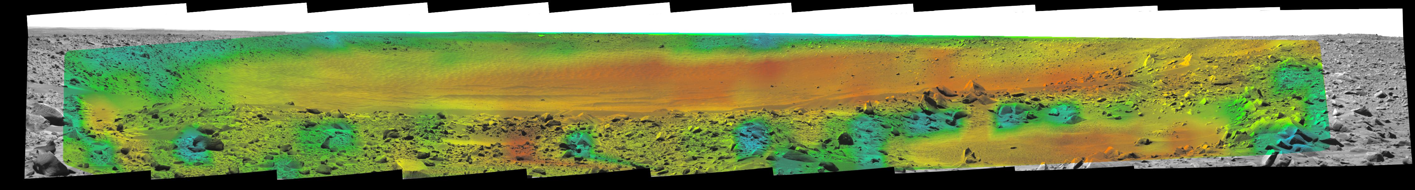
Rates of change in surface temperatures during a martian day indicate differences in particle size in and near "Bonneville Crater." This image is the fourth in a series of five with color-coded temperature information from different times of day. This one is from 2:35 p.m. local solar time at the site where NASA's Mars Exploration Rover Spirit is exploring Mars. Temperature information from Spirit's miniature thermal emission spectrometer is overlaid onto a view of the site from Spirit's panoramic camera.
In this color-coded map, quicker reddening during the day suggests sand or dust. (Red is about 270 Kelvin or 27 degrees Fahrenheit.) An example of this is in the shallow depression in the right foreground. Areas that stay blue longer into the day have larger rocks. (Blue indicates about 230 Kelvin or minus 45 Degrees F.) An example is the rock in the left foreground.
See PIA05927 for a sequence of all five frames.
