Released 19 April 2004
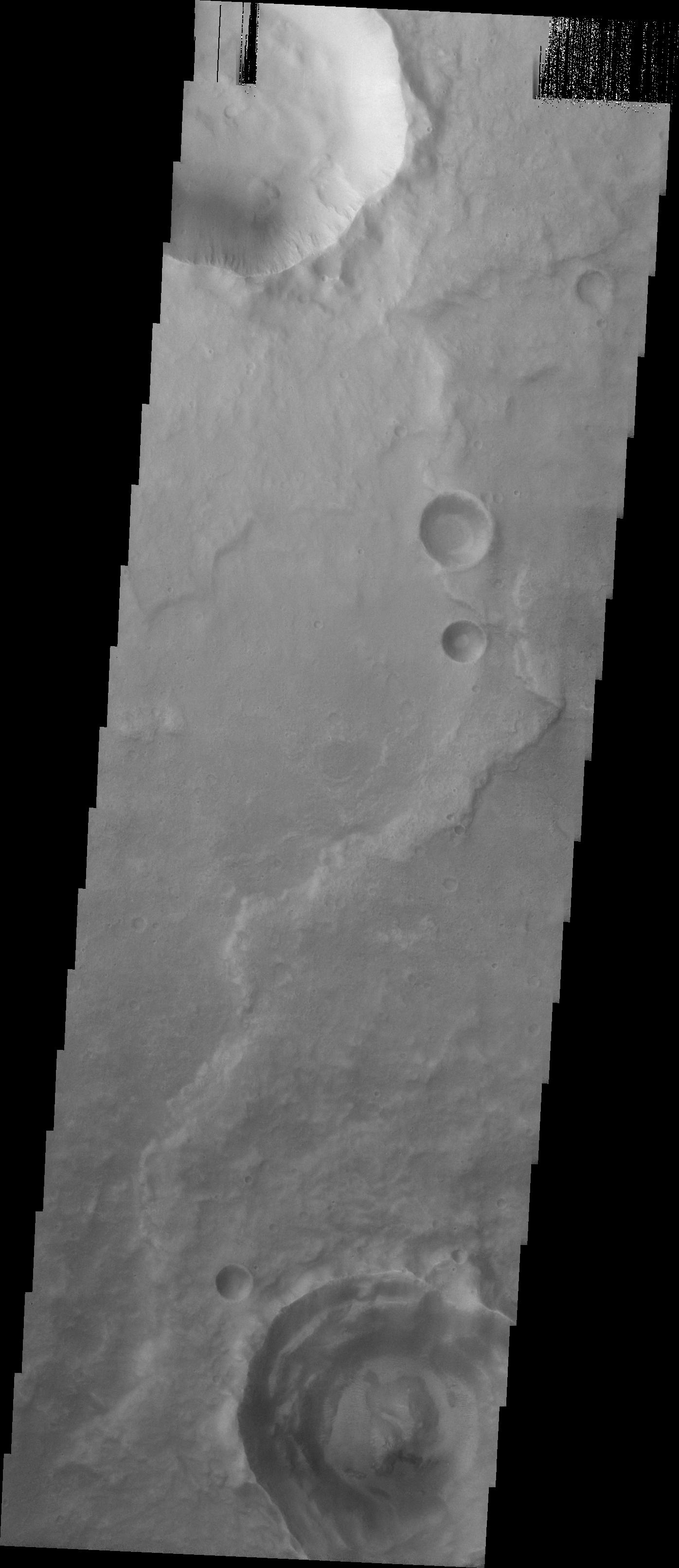
This image was acquired by the Madison #1 MSIP Team in order to answer the following question: In a cratered region, roughly where hematite was discovered, is there a larger percentage of rampart craters than in another cratered region with the same area and latitude (not longitude) where hematite was not found. The image is located at 10.1 degrees North and 342 degrees East. The site is located near the Aram Chaos Region. We were looking for rampart craters within the image and we compared the percentage of rampart craters in the site to the percentage of ramparts in other control sites to see if there is a relationship between gray hematite and rampart craters.
The Madison #1 MSIP Team (5th through 8th graders) from Phoenix, Arizona was led by a sixth grade science and math teacher.
Image information: VIS instrument. Latitude 9.6, Longitude 342.1 East (17.9 West). 19 meter/pixel resolution.
NASA and Arizona State University's Mars Education Program is offering students nationwide the opportunity to be involved in authentic Mars research by participating in the Mars Student Imaging Project (MSIP). Teams of students in grades 5 through college sophomore level have the opportunity to work with scientists, mission planners and educators on the THEMIS team at ASU's Mars Space Flight Facility, to image a site on Mars using the THEMIS visible wavelength camera. For more information go to the MSIP website: http://msip.asu.edu.
Note: this THEMIS visual image has not been radiometrically nor geometrically calibrated for this preliminary release. An empirical correction has been performed to remove instrumental effects. A linear shift has been applied in the cross-track and down-track direction to approximate spacecraft and planetary motion. Fully calibrated and geometrically projected images will be released through the Planetary Data System in accordance with Project policies at a later time.
NASA's Jet Propulsion Laboratory manages the 2001 Mars Odyssey mission for NASA's Office of Space Science, Washington, D.C. The Thermal Emission Imaging System (THEMIS) was developed by Arizona State University, Tempe, in collaboration with Raytheon Santa Barbara Remote Sensing. The THEMIS investigation is led by Dr. Philip Christensen at Arizona State University. Lockheed Martin Astronautics, Denver, is the prime contractor for the Odyssey project, and developed and built the orbiter. Mission operations are conducted jointly from Lockheed Martin and from JPL, a division of the California Institute of Technology in Pasadena.
