
Released 26 March 2004
The Odyssey spacecraft has completed a full Mars year of observations of the red planet. For the next several weeks the Image of the Day will look back over this first mars year. It will focus on four themes: 1) the poles - with the seasonal changes seen in the retreat and expansion of the caps; 2) craters - with a variety of morphologies relating to impact materials and later alteration, both infilling and exhumation; 3) channels - the clues to liquid surface flow; and 4) volcanic flow features. While some images have helped answer questions about the history of Mars, many have raised new questions that are still being investigated as Odyssey continues collecting data as it orbits Mars.
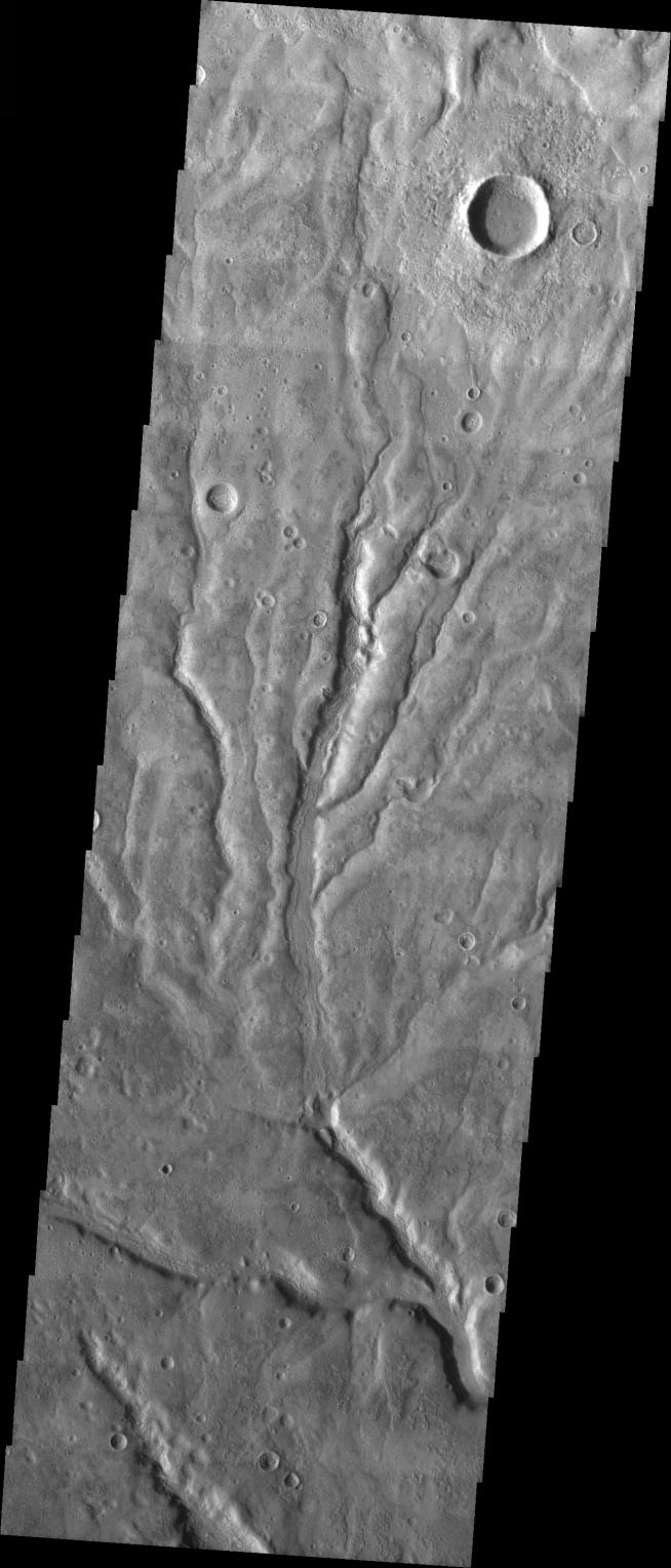
The image shows an area in the Warrego Valles region. It was collected July 6, 2003 during northern summer season. The local time is 5pm. The image shows multiple channels dissecting the terrain.
With this image, the 448th, the THEMIS Image of the Day completes its second (Earth) year. (The first image, of Nirgal Vallis, was released on 27 March 2002.) On behalf of the THEMIS team, we'd like to thank you for your continued interest and we hope you continue to come back through our third year and beyond.
Image information: VIS instrument. Latitude -42.3, Longitude 267.5 East (92.5 West). 19 meter/pixel resolution.
Note: this THEMIS visual image has not been radiometrically nor geometrically calibrated for this preliminary release. An empirical correction has been performed to remove instrumental effects. A linear shift has been applied in the cross-track and down-track direction to approximate spacecraft and planetary motion. Fully calibrated and geometrically projected images will be released through the Planetary Data System in accordance with Project policies at a later time.
NASA's Jet Propulsion Laboratory manages the 2001 Mars Odyssey mission for NASA's Office of Space Science, Washington, D.C. The Thermal Emission Imaging System (THEMIS) was developed by Arizona State University, Tempe, in collaboration with Raytheon Santa Barbara Remote Sensing. The THEMIS investigation is led by Dr. Philip Christensen at Arizona State University. Lockheed Martin Astronautics, Denver, is the prime contractor for the Odyssey project, and developed and built the orbiter. Mission operations are conducted jointly from Lockheed Martin and from JPL, a division of the California Institute of Technology in Pasadena.
 Planetary Data System


