- Original Caption Released with Image:
-
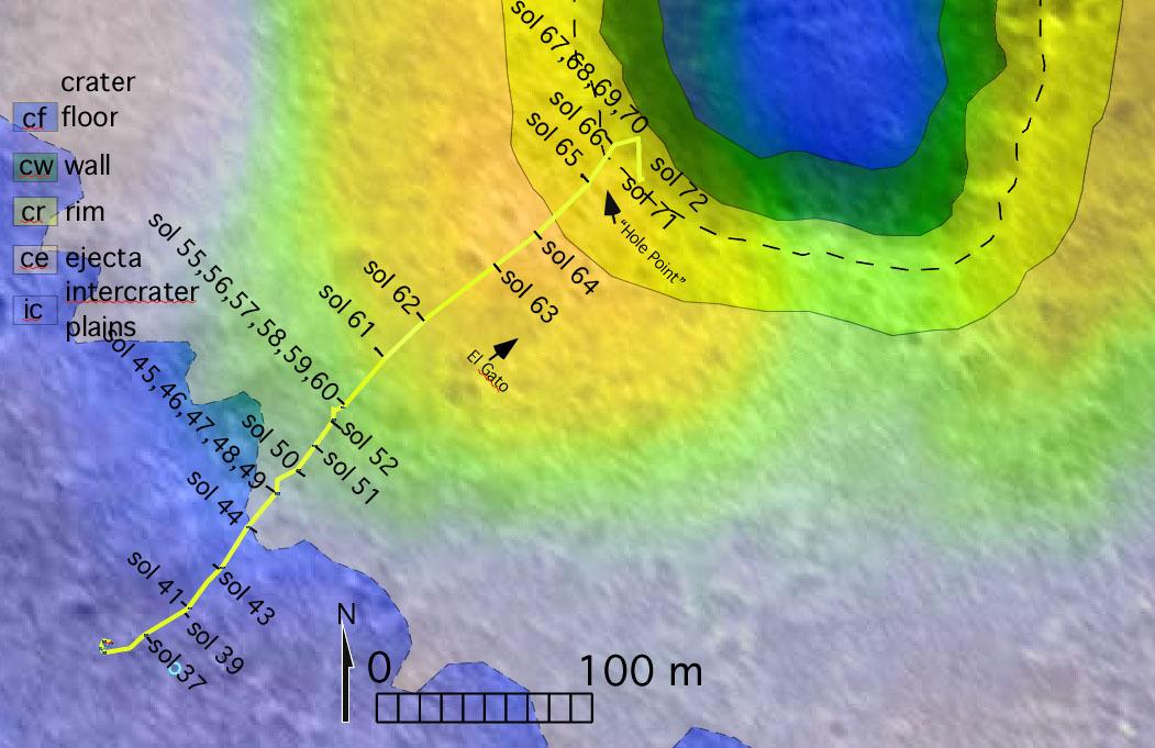
The route of NASA's Mars Exploration Rover Spirit, from its landing site to its location on sol 72 (March 16, 2004) near the rim of the large crater dubbed "Bonneville" is pictured here on this traverse map. The map consists of data from NASA's Mars Global Surveyor orbiter and NASA's Mars Odyssey orbiter. The varying terrains surrounding Bonneville--crater floor, crater wall, crater rim, crater ejecta (material ejected from the crater) and intercrater plains--are highlighted in different colors.
- Image Credit:
-
NASA/JPL/Malin Space Science Systems/ASU/New Mexico Museum of Natural
History and Science
Image Addition Date: -
2004-03-18
|
