- Original Caption Released with Image:
-
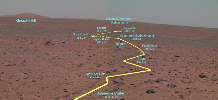
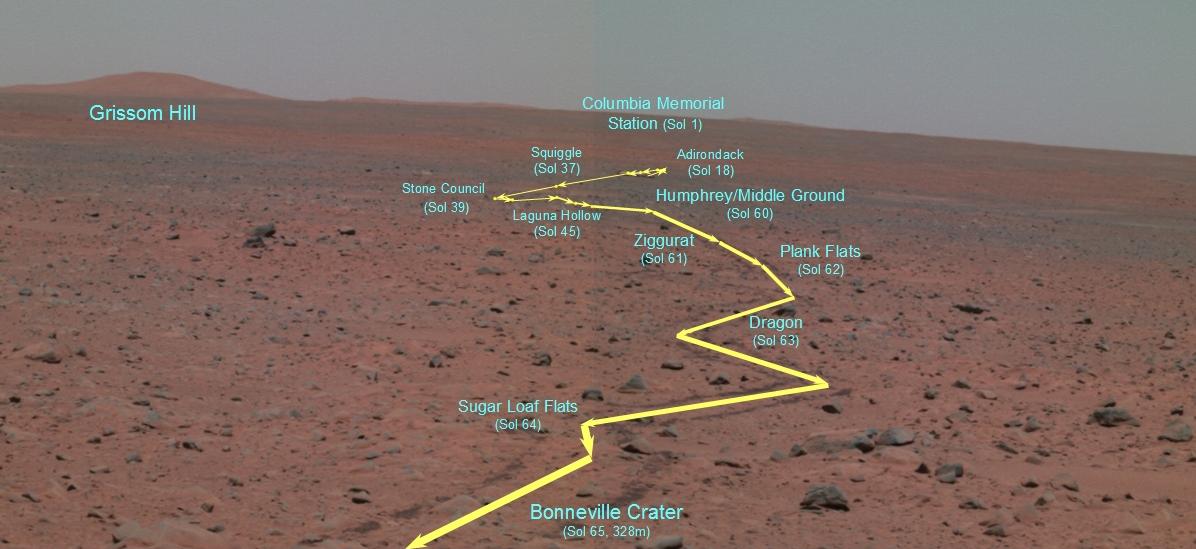
This false-color panoramic camera composite traverse map depicts the Mars Exploration Rover Spirit's journey since landing at Gusev Crater, Mars. It was generated from three of the camera's different wavelength filters (750 nanometers, 530 nanometers and 480 nanometers). This map was created on the 65th martian day, or sol, of Spirit's mission, after Spirit had traveled 328 meters (1076 feet) from its lander to the rim of the crater dubbed "Bonneville." From this high point, Spirit was able to capture with its panoramic camera the entire rover traverse. The map points out major stops that Spirit made along the way, including features nicknamed "Adirondack;" "Stone Council;" "Laguna Hollow;" and "Humphrey." Also highlighted is the landscape feature informally named "Grissom Hill" and Spirit's landing site, the Columbia Memorial Station.
- Image Credit:
-
NASA/JPL/Cornell/OSU
Image Addition Date: -
2004-03-17
|