- Original Caption Released with Image:
-
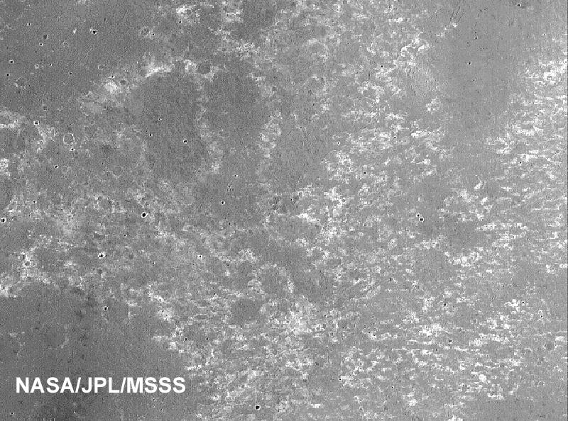
This is a portion of a previously released image (PIA02397) taken by the Mars Orbiter Camera onboard NASA's Mars Global Surveyor, showing the dark, relatively smooth plains of Meridiani Planum, where the Mars Exploration Rover Opportunity landed. The larger circular features in the upper three-quarters of the image are thought to be the locations of buried craters formed by meteorite impacts. The cluster of smaller circular features in the bottom quarter of the scene represent a field of craters formed either by simultaneous impact of many meteorites, or impact of material thrown from a much, much larger nearby crater as it formed. The dark material covering these plains includes an abundance of the iron oxide mineral, hematite, that was detected by the Mars Global Surveyor thermal emission spectrometer. The scene is located near 2.2 degrees south, 3.7 degrees west and was acquired on August 19, 1999.
- Image Credit:
-
NASA/JPL/MSSS
Image Addition Date: -
2004-03-02
|
