- Original Caption Released with Image:
-
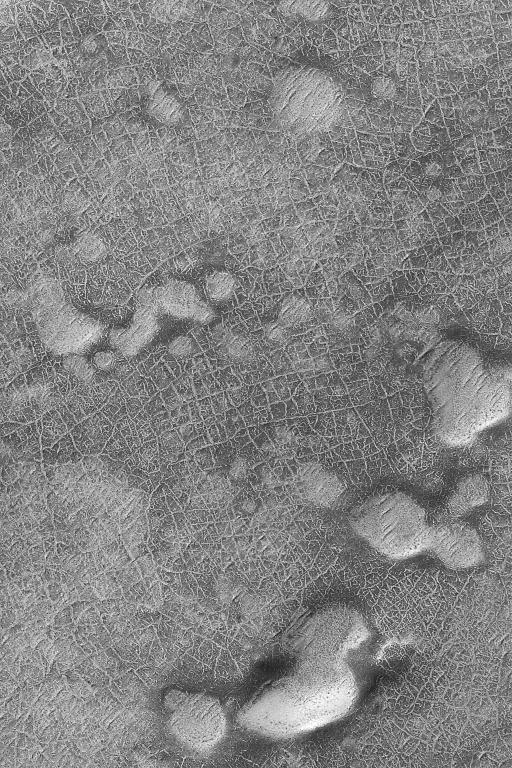
16 January 2004
Looking somewhat like a roadmap, this 3 km (1.9 mi) wide view of a cratered plain in the martian south polar region shows a plethora of cracks that form polygonal patterns. This Mars Global Surveyor (MGS) Mars Orbiter Camera (MOC) image is located near 78.9°S, 357.3°W. Polygons such as these, where they are found on Earth, would be indicators of the presence of subsurface ice. Whether the same is true for Mars is uncertain. What is certain is that modern, seasonal frost on the surface enhances the appearance of the polygons as the frost persists longer in the cracks than on adjacent plains. This southern springtime image is illuminated by sunlight from the upper left.
- Image Credit:
-
NASA/JPL/Malin Space Science Systems
Image Addition Date: -
2004-01-16
|