- Original Caption Released with Image:
-
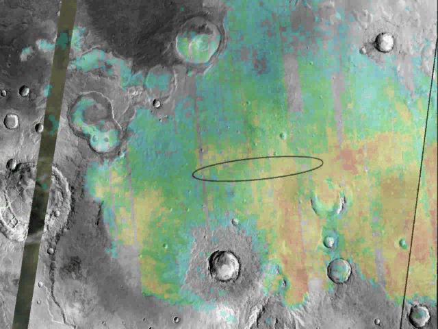
This image shows the abundance and location of the mineral grey hematite at the Mars Exploration Rover Opportunity's landing site, Meridiani Planum, Mars. Opportunity is targeted to land somewhere inside the oval, approximately 71 kilometers (45 miles) long, on January 24, 2004 Pacific Standard Time. The background surface image of Meridiani Planum is a mosaic of daytime infrared images acquired by the thermal emission imaging system instrument on NASA's Mars Odyssey Orbiter. Superimposed on this image mosaic is a rainbow-colored map showing the abundance and location of grey hematite, as mapped by the thermal emission spectrometer on NASA's Mars Global Surveyor orbiter. Red and yellow indicates higher concentrations, whereas green and blue areas denote lower levels. On Earth, grey hematite is an iron oxide mineral that typically forms in the presence of liquid water. The rover Opportunity will study the martian terrain to determine whether liquid water was present in the past when rocks were being formed, and ultimately will address whether that past environment was favorable for life.
- Image Credit:
-
NASA/JPL/ASU
Image Addition Date: -
2004-01-23
|