4 January 2004
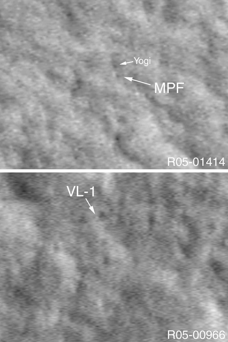
In 2003, a new technique was pioneered by the Mars Global Surveyor (MGS) Mars Orbiter Camera (MOC) experiment to allow the camera to obtain images with better than 1 meter (~ 3 ft) per pixel resolution. By pitching the spacecraft at a rate faster than the spacecraft moves in its orbit around Mars, MOC is able to obtain pictures with a down-track resolution of about 50 cm/pixel (~20 inches/pixel), although the cross-track resolution remains ~1.5 m/pixel (5 ft/pixel). One of the key goals of this image motion compensation (IMC) technique is to be able to image landers, such as the Mars Exploration Rovers, Spirit and Opportunity, on the martian surface. The two pictures shown here were acquired during the IMC testing in 2003. The first shows the location of the Mars Pathfinder lander (MPF) and the nearby boulder, Yogi. The second image shows the location of the Viking 1 (VL-1) lander. These locations were determined by using sight lines from the landers to near and far objects seen in the pictures acquired by the landers, and then matching these to locations in earlier, 1.5 to 3.0 m/pixel MOC images. Then, the IMC images, shown here, were acquired by MGS so that the actual landers, sitting on the martian surface, might be resolved. This technique only works well when the location of the lander is already fairly-well established. It would be extremely difficult to find a lander for which the location is uncertain, such as Viking 2 or Mars Polar Lander (in fact, for Mars Polar Lander, it would take over 60 years to map out the entire landing ellipse in which the spacecraft was lost). The two images shown here are illuminated from the left and show areas only a few hundred meters across.
More information about how MGS MOC will be used to help locate the Mars Exploration Rovers, Spirit and Opportunity, can be found by visiting: Finding MERs.
