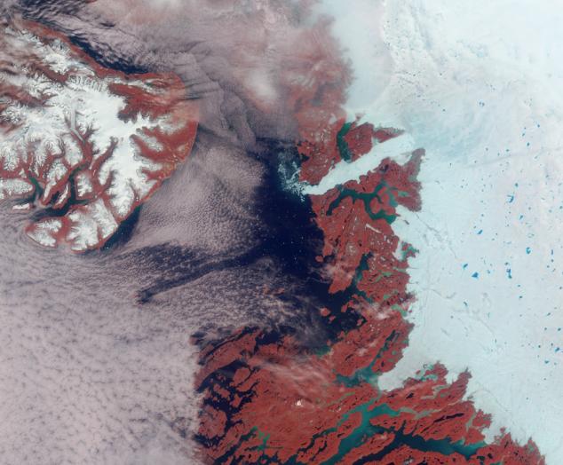
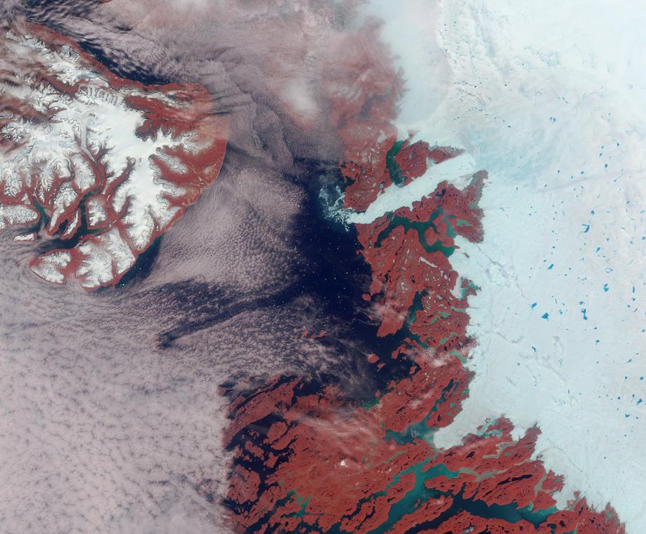
Vibrant reds, emerald greens, brilliant whites, and pastel blues adorn this view of the area surrounding the Jakobshavn Glacier on the western coast of Greenland. The image is a false-color (near-infrared, green, blue) view acquired by the Multi-angle Imaging SpectroRadiometer's nadir camera. The brightness of vegetation in the near-infrared contributes to the reddish hues; glacial silt gives rise to the green color of the water; and blue-colored melt ponds are visible in the bright white ice. A scattering of small icebergs in Disco Bay adds a touch of glittery sparkle to the scene.
The large island in the upper left is called Qeqertarsuaq. To the east of this island, and just above image center, is the outlet of the fast-flowing Jakobshavn (or Ilulissat) glacier. Jakobshavn is considered to have the highest iceberg production of all Greenland glaciers and is a major drainage outlet for a large portion of the western side of the ice sheet. Icebergs released from the glacier drift slowly with the ocean currents and pose hazards for shipping along the coast.
The Multi-angle Imaging SpectroRadiometer views the daylit Earth continuously and the entire globe between 82 degrees north and 82 degrees south latitude is observed every 9 days. These data products were generated from a portion of the imagery acquired on June 18, 2003 during Terra orbit 18615. The image cover an area of about 254 kilometers x 210 kilometers, and use data from blocks 34 to 35 within World Reference System-2 path 10.
MISR was built and is managed by NASA's Jet Propulsion Laboratory, Pasadena, CA, for NASA's Office of Earth Science, Washington, DC. The Terra satellite is managed by NASA's Goddard Space Flight Center, Greenbelt, MD. JPL is a division of the California Institute of Technology.