Released 26 December 2003
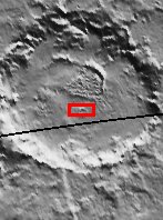
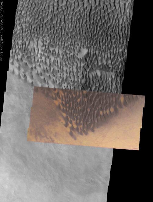
This approximately true color THEMIS VIS image shows the striking contrast between large, dark dunes and the surrounding surface. These dunes are at the southernmost edge of the Russell Crater dune field, located in the heavily cratered terrain of the southern highlands. Dust devil tracks off the eastern edge of the dune field reveal that the bright orange surface is material that can be stripped away, exposing an underlying darker surface. The gray surface to the west of the dunefield may be either a thin sand sheet or a surface preferentially stripped of the bright orange material, possibly revealing the same underlying surface that is exposed in the dust devil tracks. Bright orange areas between the dunes probably highlight areas that are protected from the wind, allowing dust to accumulate into bright orange patches.
Initial image processing and calibration by THEMIS team members J. Bell, T. McConnochie, and D. Savransky at Cornell University; additional processing and final color balance by space artist Don Davis.
Image information: VIS instrument. Latitude -54.8, Longitude 12.4 East (347.6 West). 19 meter/pixel resolution.
Note: this THEMIS visual image has not been radiometrically nor geometrically calibrated for this preliminary release. An empirical correction has been performed to remove instrumental effects. A linear shift has been applied in the cross-track and down-track direction to approximate spacecraft and planetary motion. Fully calibrated and geometrically projected images will be released through the Planetary Data System in accordance with Project policies at a later time.
NASA's Jet Propulsion Laboratory manages the 2001 Mars Odyssey mission for NASA's Office of Space Science, Washington, D.C. The Thermal Emission Imaging System (THEMIS) was developed by Arizona State University, Tempe, in collaboration with Raytheon Santa Barbara Remote Sensing. The THEMIS investigation is led by Dr. Philip Christensen at Arizona State University. Lockheed Martin Astronautics, Denver, is the prime contractor for the Odyssey project, and developed and built the orbiter. Mission operations are conducted jointly from Lockheed Martin and from JPL, a division of the California Institute of Technology in Pasadena.