- Original Caption Released with Image:
-
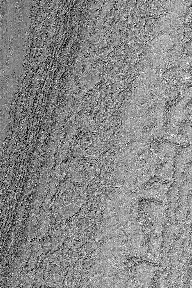
MGS MOC Release No. MOC2-559, 29 November 2003 Both the north and south polar regions of Mars exhibit thick deposits of layered sediment. These have been known since the Mariner 9 (1972) and Viking (1976-1980) orbiter missions. The layered deposits are considered to contain a record of climate changes that occurred in the relatively recent martian past, but most of that record will have to wait until some time in the future when a lander or people can go there to study them. Meanwhile, pictures such as this from the Mars Global Surveyor (MGS) Mars Orbiter Camera (MOC) provide opportunities to view the layers where they are exposed on slopes. Here, numerous layers have been exposed by erosion in the south polar region. The picture was obtained in October 2003 and is located near 86.4°S, 112.4°W. The image covers an area 3 km (1.9 mi) wide, and is illuminated by sunlight from the upper left.
- Image Credit:
-
NASA/JPL/Malin Space Science Systems
Image Addition Date: -
2003-12-03
|