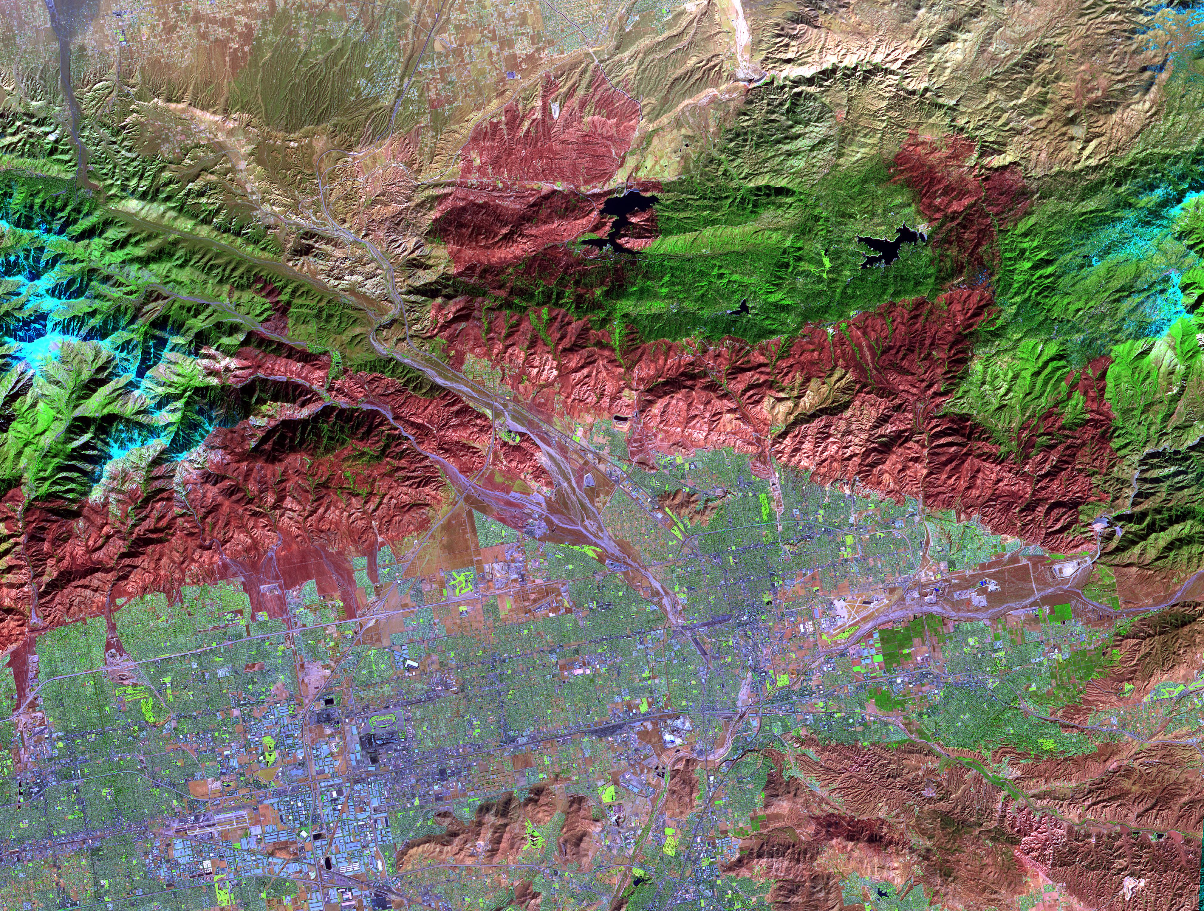
On November 18, 2003, the Advanced Spaceborne Thermal Emission and Reflection Radiometer (ASTER) on NASA's Terra satellite acquired this image of the Old Fire/Grand Prix fire east of Los Angeles. The image is being processed by NASA's Wildfire Response Team and will be sent to the United States Department of Agriculture's Forest Service Remote Sensing Applications Center (RSAC) which provides interpretation services to Burned Area Emergency Response (BAER) teams to assist in mapping the severity of the burned areas. The image combines data from the visible and infrared wavelength regions to highlight the burned areas.
With its 14 spectral bands from the visible to the thermal infrared wavelength region, and its high spatial resolution of 15 to 90 meters (about 50 to 300 feet), ASTER images Earth to map and monitor the changing surface of our planet.
ASTER is one of five Earth-observing instruments launched December 18, 1999, on NASA's Terra satellite. The instrument was built by Japan's Ministry of Economy, Trade and Industry. A joint U.S./Japan science team is responsible for validation and calibration of the instrument and the data products.
The broad spectral coverage and high spectral resolution of ASTER provides scientists in numerous disciplines with critical information for surface mapping, and monitoring of dynamic conditions and temporal change. Example applications are: monitoring glacial advances and retreats; monitoring potentially active volcanoes; identifying crop stress; determining cloud morphology and physical properties; wetlands evaluation; thermal pollution monitoring; coral reef degradation; surface temperature mapping of soils and geology; and measuring surface heat balance.
Michael Abrams at NASA's Jet Propulsion Laboratory (JPL), Pasadena, Calif., is the U.S. science team leader; Bjorn Eng of JPL is the project manager. The Terra mission is part of NASA's Earth Science Enterprise, a long- term research effort dedicated to understanding the Earth as an integrated system and applying Earth System Science to improve prediction of climate, weather, and natural hazards using the unique vantage point of space.
Size: 60 by 45 kilometers ( 37.5 by 28.1 miles)
Location: 34.5 degrees North latitude, 117.1 degrees West longitude
Orientation: North at top
Image Data: ASTER bands 1, 3, and 4
Original Data Resolution: 15 meters (49.2 feet)
Date Acquired: November 18, 2003
