Visit NASA's Home Page Jet Propulsion Laboratory California Institute of Technology View the NASA Portal Click to search JPL Visit JPL Home Page Proceed to JPL's Earth Page Proceed to JPL's Solar System Page Proceed to JPL's Stars & Galaxies Page Proceed to JPL's Technology Page Proceed to JPL's People and Facilities Photojournal Home Page View the Photojournal Image Gallery
Top navigation bar

PIA04767: Pits and Layers
Target Name: Mars
Is a satellite of: Sol (our sun)
Mission: Mars Global Surveyor (MGS)
Spacecraft: Mars Global Surveyor Orbiter
Instrument: Mars Orbiter Camera
Product Size: 1536 samples x 2304 lines
Produced By: Malin Space Science Systems
Full-Res TIFF: PIA04767.tif (3.377 MB)
Full-Res JPEG: PIA04767.jpg (540.8 kB)

Click on the image to download a moderately sized image in JPEG format (possibly reduced in size from original).

Original Caption Released with Image:
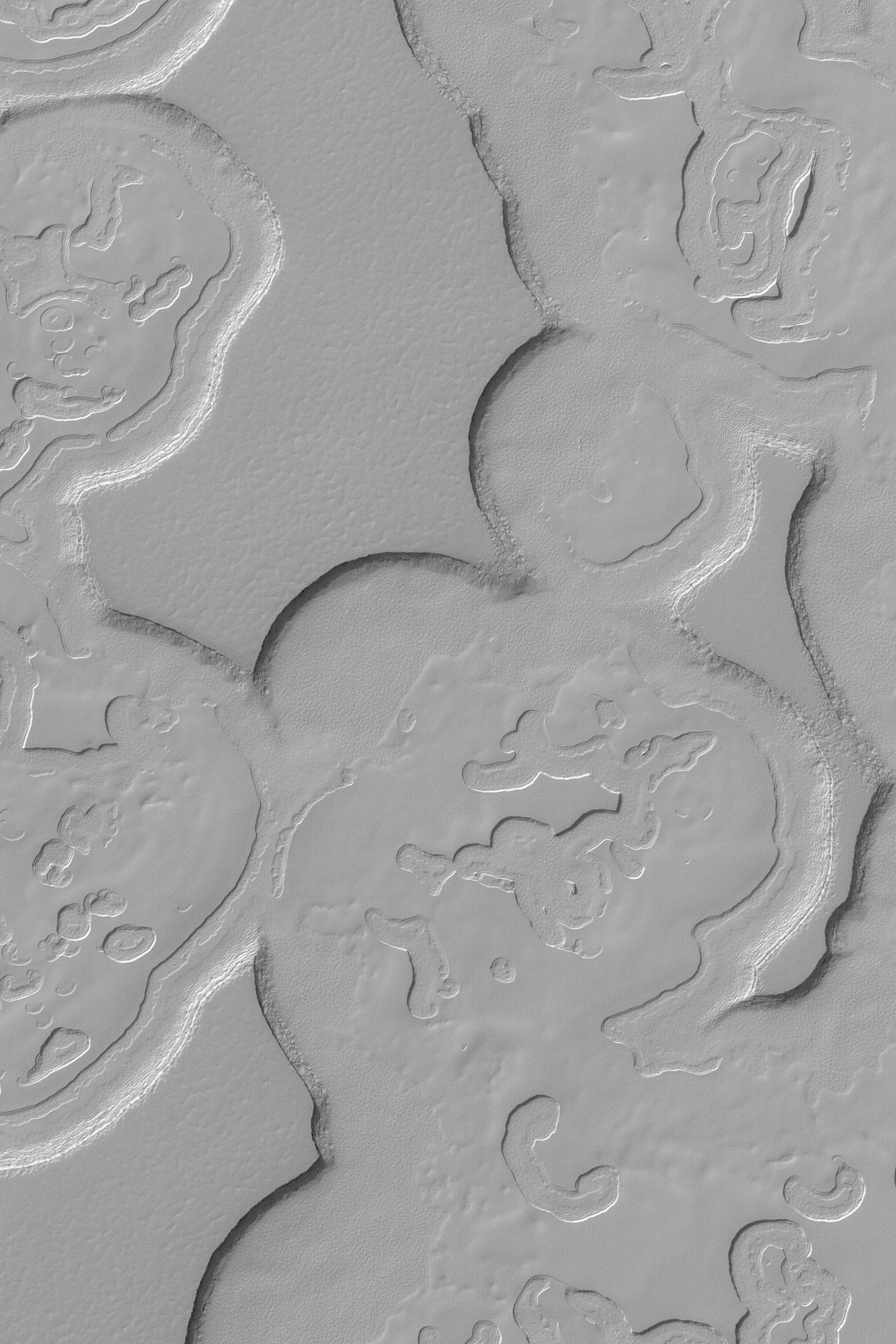
MGS MOC Release No. MOC2-497, 28 September 2003

This Mars Global Surveyor (MGS) Mars Orbiter Camera (MOC) image shows some of the scarps, mesas, and circular depressions of the south polar residual cap. These landforms are created in material consisting largely of frozen carbon dioxide. Each layer is a record of a past, colder martian climate. This August 2003 picture is located near 86.9°S, 342.8°W, and covers an area 3 km (1.9 mi) across. The scene is illuminated by sunlight from the upper left.

Image Credit:
NASA/JPL/Malin Space Science Systems


Latest Images Search Methods Animations Spacecraft & Telescopes Related Links Privacy/Copyright Image Use Policy Feedback Frequently Asked Questions Photojournal Home Page First Gov Freedom of Information Act NASA Home Page Webmaster
Bottom navigation bar