- Original Caption Released with Image:
-
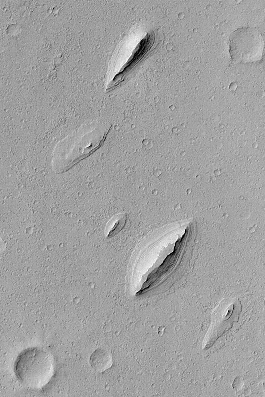
MGS MOC Release No. MOC2-389, 12 June 2003 This Mars Global Surveyor (MGS) Mars Orbiter Camera (MOC) image shows wind-sculpted remnants of layered sedimentary rock that once completely covered the northwestern floor of Henry Crater, an ancient impact basin located at 11.7°N, 336.4°W. These landforms, shaped somewhat like inverted boat hulls, are "textbook examples" of a wind erosion form known as a yardang. The image covers an area 2.3 km (1.4 mi) wide; sunlight illuminates the scene from the left.
- Image Credit:
-
NASA/JPL/Malin Space Science Systems
Image Addition Date: -
2003-06-12
|