- Original Caption Released with Image:
-
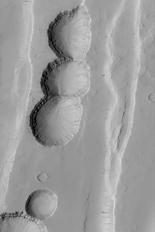
MGS MOC Release No. MOC2-386, 9 June 2003 This chain of pits formed by collapse as faulting extended the upper crust in the Tractus Catena region of Mars. The layered bedrock can be seen in the upper walls of each pit in this Mars Global Surveyor (MGS) Mars Orbiter Camera (MOC) image. The picture covers an area about 3 km (1.9 mi) wide near 28.5°N, 102.9°W. Sunlight illuminates the scene from the left.
- Image Credit:
-
NASA/JPL/Malin Space Science Systems
Image Addition Date: -
2003-06-12
|
