- Original Caption Released with Image:
-
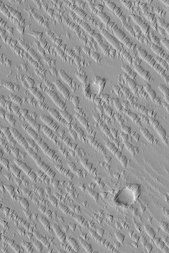
MGS MOC Release No. MOC2-373, 27 May 2003 This May 2003 Mars Global Surveyor (MGS) Mars Orbiter Camera (MOC) image shows a suite of wind-sculpted ridges on the plains northwest of the Tharsis volcano, Ascraeus Mons. The two circular features are old meteor impact craters. The ridges running from upper left toward lower right may have once been sand dunes. These dunes and the two craters were later covered by thick accumulations of dust or volcanic ash, and this fine material was later eroded by wind to form the somewhat triangular tails and markings that point toward the upper right. The area shown is 1.7 km (1.1 mi) wide and located near 16.0°N, 107.6°W. Sunlight illuminates the scene from the lower left.
- Image Credit:
-
NASA/JPL/Malin Space Science Systems
Image Addition Date: -
2003-05-27
|