- Original Caption Released with Image:
-
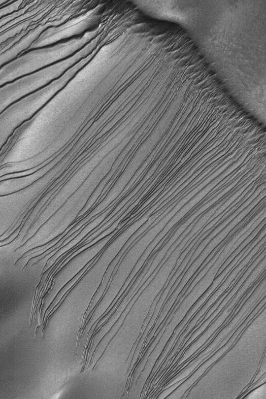
MGS MOC Release No. MOC2-343, 27 April 2003 This Mars Global Surveyor (MGS) Mars Orbiter Camera (MOC) image shows the mysterious dune gullies of Russell Crater. The terrain shown here is one very large sand dune; the surface slopes from upper right toward lower left. Gullies start on the slope at the upper right and indicate flow toward the lower left. These might have formed by the presence of a fluid-either liquid or gas-mixed with sand that avalanched down the dune slope. Or not. Their origin is unknown, although it is known that they tend to occur only on slopes facing southward. The MOC team has re-imaged these gullies several times in the past three Mars years, but no new gullies have formed. The picture covers an area about 3 km (1.9 mi) wide near 54.5°S, 347.3°W. Sunlight illuminates the scene from the upper left.
- Image Credit:
-
NASA/JPL/Malin Space Science Systems
Image Addition Date: -
2003-04-28
|
