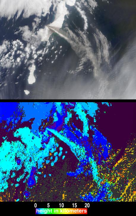
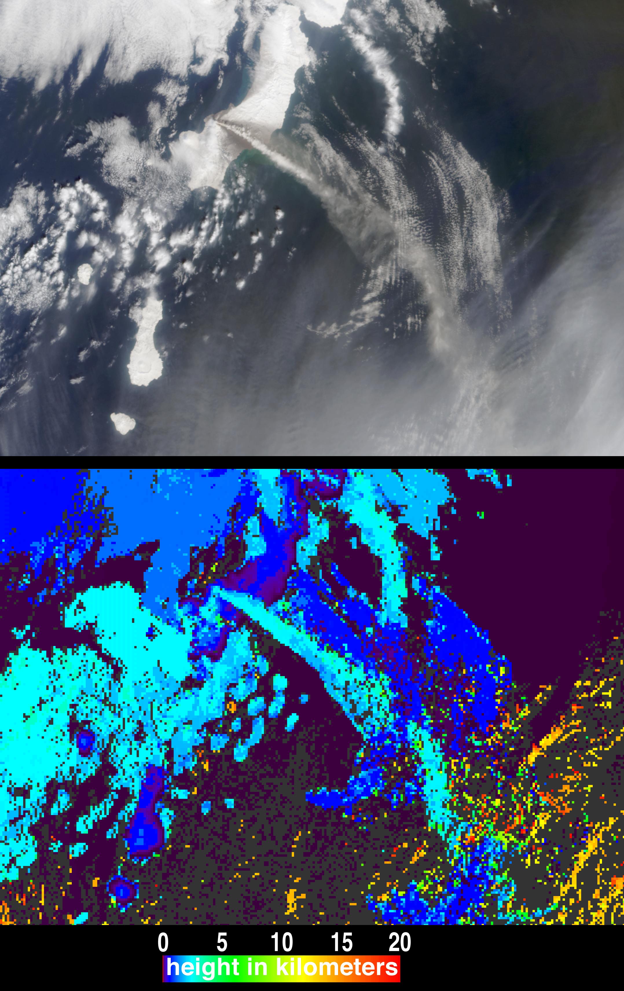
The height and motion of the ash and gas plume from the April 22, 2003, eruption of the Chikurachki volcano is portrayed in these views from the Multi-angle Imaging SpectroRadiometer (MISR). Situated within the northern portion of the volcanically active Kuril Island group, the Chikurachki volcano is an active stratovolcano on Russia's Paramushir Island (just south of the Kamchatka Peninsula).
In the upper panel of the still image pair, this scene is displayed as a natural-color view from MISR's vertical-viewing (nadir) camera. The white and brownish-grey plume streaks several hundred kilometers from the eastern edge of Paramushir Island toward the southeast. The darker areas of the plume typically indicate volcanic ash, while the white portions of the plume indicate entrained water droplets and ice. According to the Kamchatkan Volcanic Eruptions Response Team (KVERT), the temperature of the plume near the volcano on April 22 was -12° C.
The lower panel shows heights derived from automated stereoscopic processing of MISR's multi-angle imagery, in which the plume is determined to reach heights of about 2.5 kilometers above sea level. Heights for clouds above and below the eruption plume were also retrieved, including the high-altitude cirrus clouds in the lower left (orange pixels). The distinctive patterns of these features provide sufficient spatial contrast for MISR's stereo height retrieval to perform automated feature matching between the images acquired at different view angles. Places where clouds or other factors precluded a height retrieval are shown in dark gray.
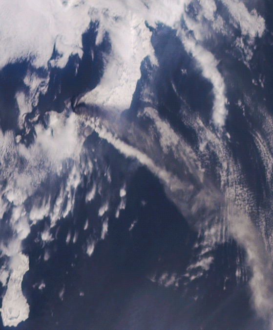
The multi-angle "fly-over" animation (below) allows the motion of the plume and of the surrounding clouds to be directly observed. The frames of the animation consist of data acquired by the 70-degree, 60-degree, 46-degree and 26-degree forward-viewing cameras in sequence, followed by the images from the nadir camera and each of the four backward-viewing cameras, ending with the view from the 70-degree backward camera.
The Multi-angle Imaging SpectroRadiometer observes the daylit Earth continuously from pole to pole, and every 9 days views the entire globe between 82 degrees north and 82 degrees south latitude. These data products were generated from a portion of the imagery acquired during Terra orbit 17776. The panels cover an area of approximately 296 kilometers x 216 kilometers (still images) and 185 kilometers x 154 kilometers (animation), and utilize data from blocks 50 to 51 within World Reference System-2 path 100.
MISR was built and is managed by NASA's Jet Propulsion Laboratory, Pasadena, CA, for NASA's Office of Earth Science, Washington, DC. The Terra satellite is managed by NASA's Goddard Space Flight Center, Greenbelt, MD. JPL is a division of the California Institute of Technology.
