 |  |  |
Animation:
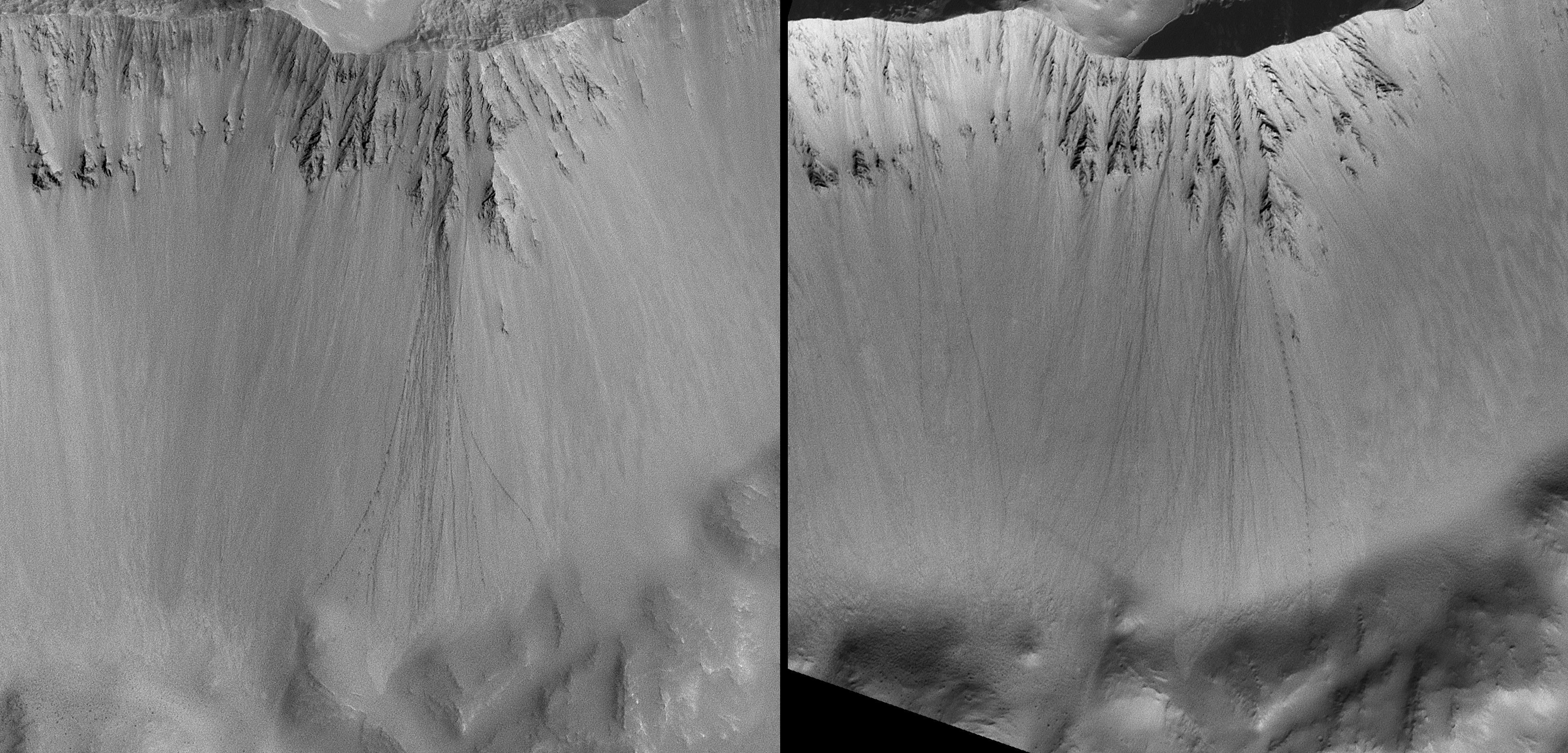
Rolling Stones Make New Boulder Tracks | Figure 1:
Context View; North is Up | Figure 2:
Dune Gully Orientation |
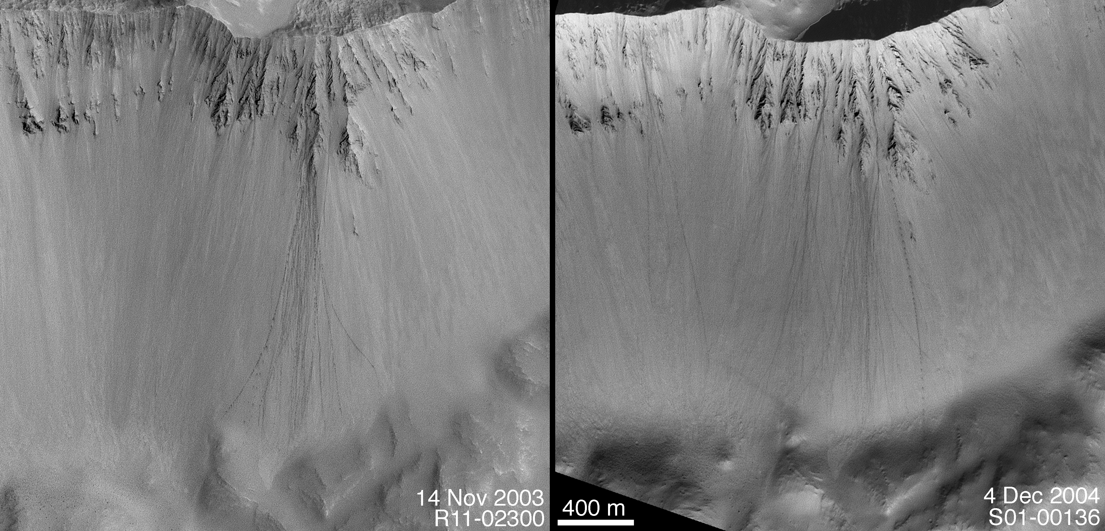
When a boulder rolls down a dusty slope, it can leave behind a trail of depressions. Usually known as boulder tracks, these features have been documented and studied on Earth, the Moon, and Mars. Geologists studying the Moon and Mars can use these tracks to learn about the physical properties of the fine-grained debris encountered by the boulder as it rolled down the slope.
Because of the high-resolution capability (0.5 to 12 meters, 1.6 to 39 feet, per pixel) of the Mars Orbiter Camera on NASA's Mars Global Surveyor spacecraft, dozens of boulder track sites have been identified on the red planet.
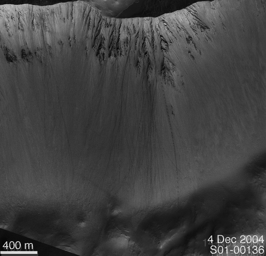
A Mars Orbiter Camera image of one set of boulder tracks in a south mid-latitude crater (located near 35.8 degrees south latitude, 158.4 degrees west longitude) was obtained on Nov. 14, 2003, (left). A second image of the same site, from Dec. 4, 2004, (right) shows that more than a dozen new boulder tracks formed on the crater wall during the intervening time. Mars is an active planet, with geologic changes occurring -- at some scale -- every day. In this case, some time between mid November 2003 and early December 2004, a suite of boulders became dislodged from the crater wall, then rolled and perhaps bounced their way to the crater floor.
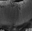
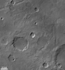
Wider context for the site can be seen in a mosaic of Mars Orbiter Camera wide-angle images acquired in May 1999 (figure 2). The white box indicates the location of the later, higher-resolution views.
Why the new boulders slid down the slope is unknown. This is the product of a mass movement (landsliding) process. That is, gravity is the main culprit. Whether the boulder motion was triggered by something -- a seismic event ("Marsquake") or strong winds -- is not known. Also unknown is whether all of the new boulder tracks formed at the same time, in response to a single event, or rolled downhill one at a time over the nearly 13-month period.
The Mars Orbiter Camera was built and is operated by Malin Space Science Systems, San Diego, Calif. Mars Global Surveyor left Earth on Nov. 7, 1996, and began orbiting Mars on Sept. 12, 1997. JPL, a division of the California Institute of Technology, Pasadena, manages Mars Global Surveyor for NASA's Science Mission Directorate, Washington.

