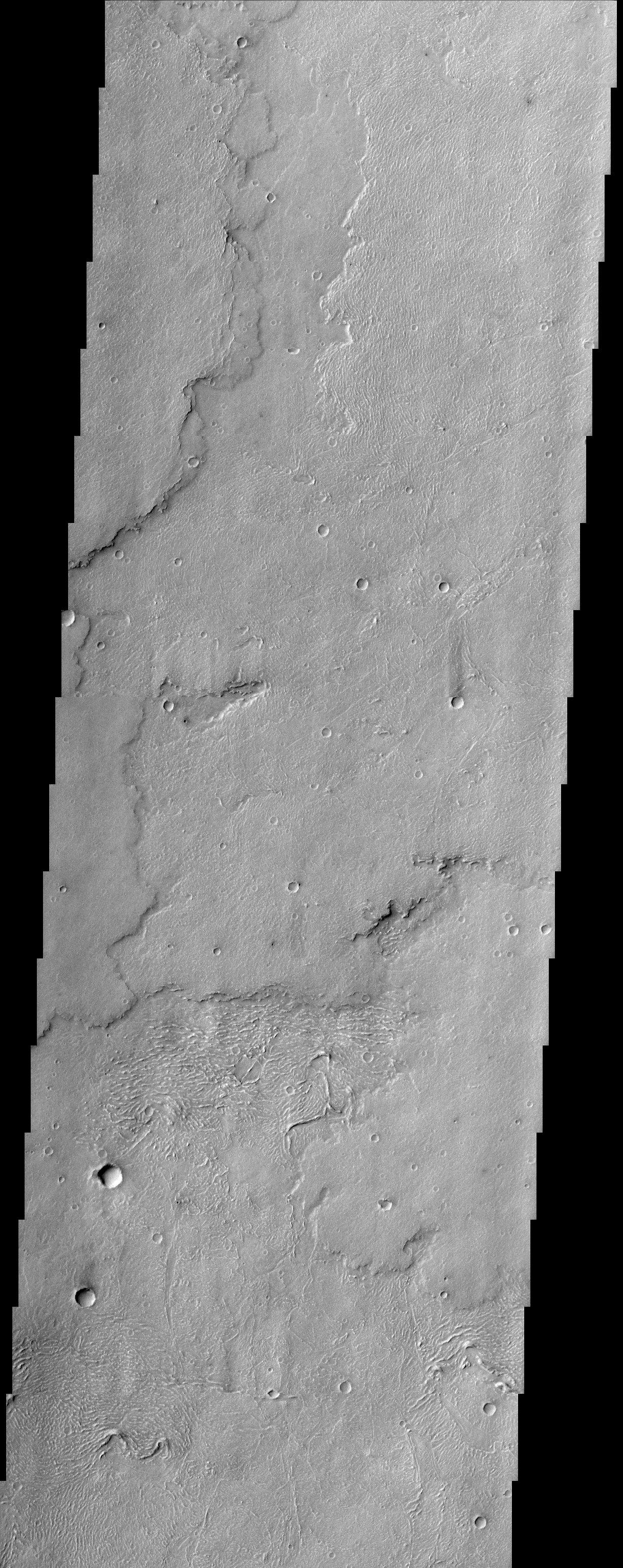
This THEMIS image captures a portion of several lava flows in Daedalia Planum southwest of the Arsia Mons shield volcano. Textures characteristic of the variable surface roughness associated with different lava flows in this region are easily seen. The lobate edges of the flows are distinctive, and permit the discrimination of many overlapping individual flows. The surfaces of some flows look wrinkly and ropy, probably indicating a relatively fluid type of lava flow referred to as pahoehoe. The surface textures of lava flows can thus sometimes be used for comparative purposes to infer lava viscosity and effusion rates. Numerous parallel curved ridges are visible on the upper surfaces of some of the lava flows. These ridges make the flow surface look somewhat ropy, and at smaller scales this flow might be referred to as pahoehoe, however, these features are probably better referred to as pressure ridges. Pressure ridges form on the surface of a lava flow when the upper part of the flow is exposed to air, cooling it, but the insulated much warmer interior of the flow continues to move down slope (and more material is pushed forward from behind), causing the surface to compress and pile up like a rug.
Note: this THEMIS visual image has not been radiometrically nor geometrically calibrated for this preliminary release. An empirical correction has been performed to remove instrumental effects. A linear shift has been applied in the cross-track and down-track direction to approximate spacecraft and planetary motion. Fully calibrated and geometrically projected images will be released through the Planetary Data System in accordance with Project policies at a later time.
NASA's Jet Propulsion Laboratory manages the 2001 Mars Odyssey mission for NASA's Office of Space Science, Washington, D.C. The Thermal Emission Imaging System (THEMIS) was developed by Arizona State University, Tempe, in collaboration with Raytheon Santa Barbara Remote Sensing. The THEMIS investigation is led by Dr. Philip Christensen at Arizona State University. Lockheed Martin Astronautics, Denver, is the prime contractor for the Odyssey project, and developed and built the orbiter. Mission operations are conducted jointly from Lockheed Martin and from JPL, a division of the California Institute of Technology in Pasadena.
