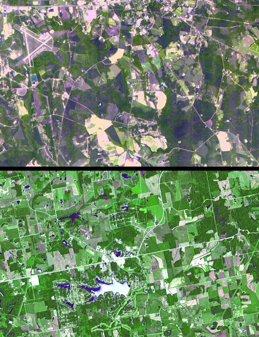
The towns of Santa Claus, Ga., (top) and Santa Claus, Ind. (bottom), are shown in these two images from the Advanced Spaceborne Thermal Emission and Reflection Radiometer (ASTER) instrument on NASA's Terra satellite. They are the only two Santa Claus towns in the United States with post offices and zip codes, although there are 11 towns with this name in the United States. Santa Claus, Ga. is located in Toombs County, and has a population of 237. Santa Claus, Ind. is located in Spencer County, and has a population of 2,041. Its name was accepted by the United States Postal Service in 1856. The images were acquired on July 3, 2000 (top) and June 16, 2001 (bottom), respectively.
With its 14 spectral bands from the visible to the thermal infrared wavelength region, and its high spatial resolution of 15 to 90 meters (about 50 to 300 feet), ASTER images Earth to map and monitor the changing surface of our planet.
ASTER is one of five Earth-observing instruments launched December 18, 1999, on NASA's Terra satellite. The instrument was built by Japan's Ministry of Economy, Trade and Industry. A joint U.S./Japan science team is responsible for validation and calibration of the instrument and the data products.
The broad spectral coverage and high spectral resolution of ASTER will provide scientists in numerous disciplines with critical information for surface mapping, and monitoring of dynamic conditions and temporal change. Example applications are: monitoring glacial advances and retreats; monitoring potentially active volcanoes; identifying crop stress; determining cloud morphology and physical properties; wetlands evaluation; thermal pollution monitoring; coral reef degradation; surface temperature mapping of soils and geology; and measuring surface heat balance.
Dr. Anne Kahle at NASA's Jet Propulsion Laboratory, Pasadena, Calif., is the U.S. science team leader; Bjorn Eng of JPL is the project manager. The Terra mission is part of NASA's Earth Science Enterprise, a long-term research effort to understand and protect our home planet. Through the study of Earth, NASA will help to provide sound science to policy and economic decision-makers so as to better life here, while developing the technologies needed to explore the universe and search for life beyond our home planet.
Size: 10.5 by 6.75 kilometers (6.5 by 4.2 miles)
Location: 32.2 degrees North latitude, 82.3 degrees West longitude; and 38.1 degrees North latitude, 86.9 degrees West longitude
Orientation: North at top
Image Data: ASTER bands 1, 2 and 3
Original Data Resolution: 15 meters (49.2 feet)
Dates Acquired: June 16, 2001 and July 3, 2000
 Planetary Data System


