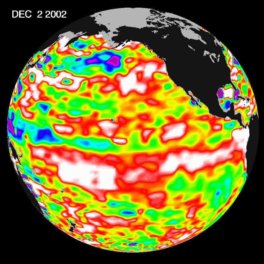
The latest image from NASA's Jason oceanography satellite, taken during a 10-day collection cycle ending December 2, 2002, shows the Pacific dominated by two significant areas of higher-than-normal sealevel (warmer ocean temperatures). In the central equatorial Pacific, the large area of higher than normal sea surface heights(warmer than normal sea surface temperatures) associated with growing El Nińo conditions has recently migrated eastward toward the coast of South America. Meanwhile, the influence of the 20- to 30-year larger than El Nińo/La Nińa pattern called the Pacific Decadal Oscillation continues to create warm, higher-than-normal sea-surface heights in the north Pacific that are connected in a warm horseshoe pattern with the western and southern Pacific. Sea-surface heights are a measure of how much heat is stored in the ocean below. This heat influences both present weather and future planetary climate events.
The image shows red areas in the north Pacific and at the equator that are about 10 centimeters (4 inches) above normal; white areas indicate sea surface heights between 14 and 32 centimeters (6 to 13 inches) above normal. These regions contrast with the western tropical Pacific, where lower-than-normal sea levels (blue areas) have developed that are between 5 and 13 centimeters (2 and 5 inches) below normal, while purple areas range from 14 to 18 centimeters (6 to 7 inches) below normal. Along the equator, the red sea surface heights equate to sea surface temperature departures greater than one degree Celsius (two degrees Fahrenheit) and the white sea surface heights are sea surface temperatures 1.5 to 2.5 degrees Celsius(three to five degrees Fahrenheit) above normal.
The U.S. portion of the Jason mission is managed by JPL for NASA's Earth Science Enterprise, Washington, D.C. Research on Earth's oceans using Jason and other space-based capabilities is conducted by NASA's Earth Science Enterprise to better understand and protect our home planet.
