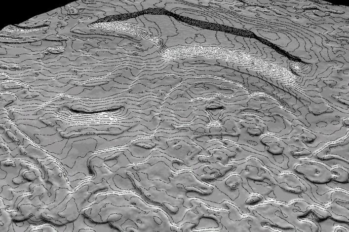
A 50-cm contour map of part of Mars' south polar ice cap. The region shown is roughly a kilometer on a side. The shaded relief model is shown with a tenfold vertical exaggeration.
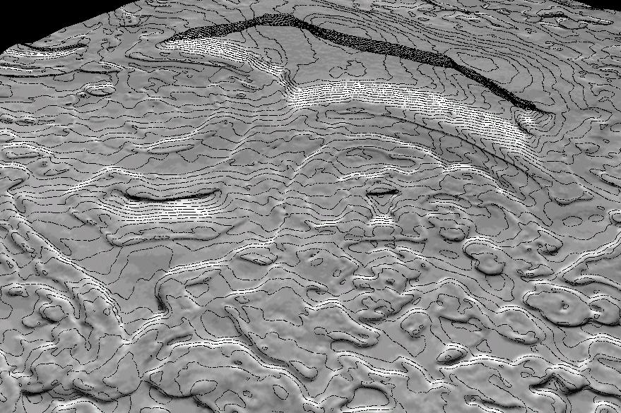
This high resolution Mars Global Surveyor (MGS) topographic model of the surface of Mars is created by combining Mars Orbiter Laser Altimeter (MOLA) gridded topographic data base with information from Mars Orbiter Camera (MOC) Narrow Angle (NA) high resolution images. The top image is a shaded relief model derived from the MGS MOLA gridded topography for a small part of the cap near 87°S 348°W; the area covered is about 3x3 km and the MOLA resolution about 230 meters/pixel. The bottom image is an enhanced shaded relief model of the same area derived by adding high-resolution topographic information from a MOC NA image data to the MOLA topography model. This yields a 3-D model that has a horizontal resolution of 2.75 meters; both models are shown with a 10x vertical exaggeration. Using shape-from-shading or photoclinometry techniques, MOCNA image m0906496 was used to derive high resolution (meter-scale) topography. The photometric properties of the surface, including albedo variations, and scattering of the atmosphere were carefully modeled by constraining the low-frequencies of the MOC NA photoclinometry model to match the high-quality MOLA data.