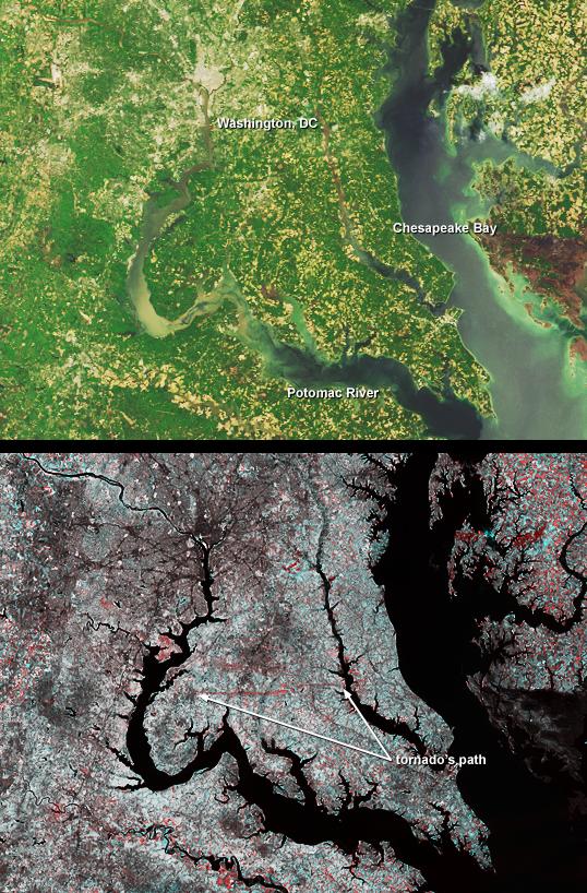
A category F4 tornado tore through La Plata, Maryland on April 28, 2002, killing 5 and injuring more than 100 people. Vegetation and surface structures were pulled up or damaged along a swath measuring 39 kilometers long. This pair of images from the Multi-angle Imaging SpectroRadiometer (MISR) illustrates the strip of flattened vegetation left by the tornado.
The top image was acquired by MISR's nadir (vertical-viewing) camera on May 1, 2002. The tornado swath is barely visible in this natural-color view, which has a spatial resolution of 275 meters. In the lower view, near infrared data from the May 1 date are combined with data from about one year earlier (April 28, 2001) to highlight vegetation changes between the two dates. Here, the 2002 (post tornado) data are displayed as blue/green, and the 2001 data as red. In this temporal false color composite, areas with less vegetation on the later date appear bright red. The horizontal red line between the Potomac and Patuxent rivers in Maryland indicates the swath cut by the tornado. Washington, DC is located in the upper left-hand quadrant of the images. The images utilize data from blocks 59 to 61 within World Reference System-2 path 15.
Another view of the area damaged by the tornado at a spatial resolution of 15 meters per pixel is available from the Advanced Spaceborne Thermal Emission and Reflection Radiometer (ASTER), also onboard the Terra satellite.
MISR was built and is managed by NASA's Jet Propulsion Laboratory, Pasadena, CA, for NASA's Office of Earth Science, Washington, DC. The Terra satellite is managed by NASA's Goddard Space Flight Center, Greenbelt, MD. JPL is a division of the California Institute of Technology.
