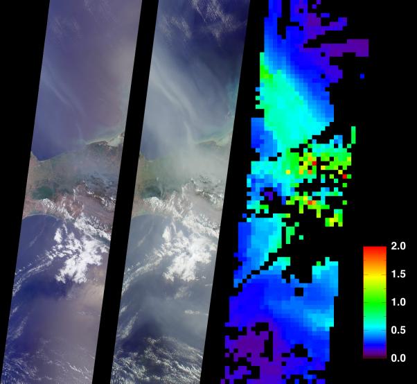
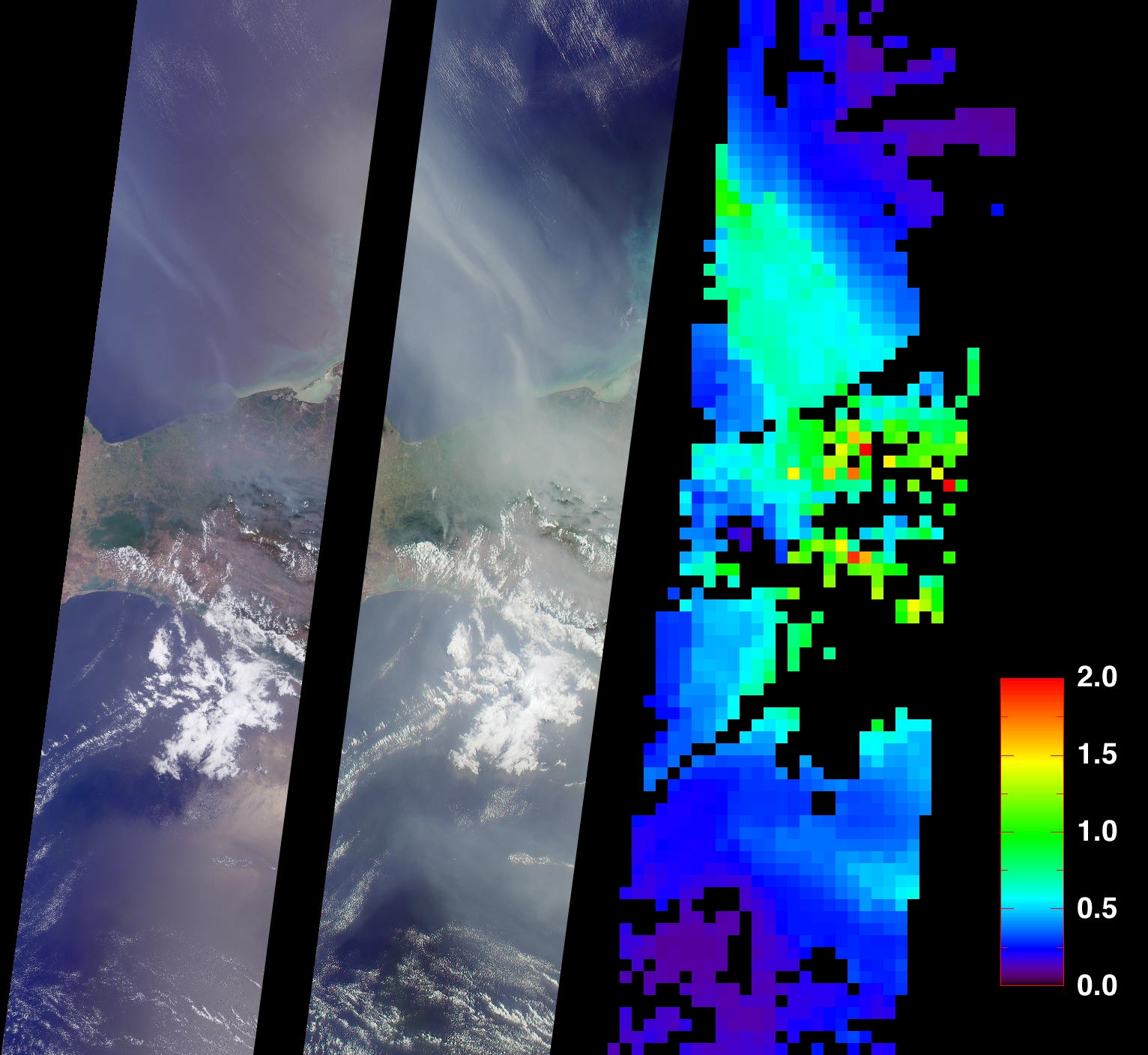
On May 2, 2002, numerous fires in southern Mexico sent smoke drifting northward over the Gulf of Mexico. These views from the Multi-angle Imaging SpectroRadiometer illustrate the smoke extent over parts of the Gulf and the southern Mexican states of Tabasco, Campeche and Chiapas. At the same time, dozens of other fires were also burning in the Yucatan Peninsula and across Central America. A similar situation occurred in May and June of 1998, when Central American fires resulted in air quality warnings for several U.S. States.
The image on the left is a natural color view acquired by MISR's vertical-viewing (nadir) camera. Smoke is visible, but sunglint in some ocean areas makes detection difficult. The middle image, on the other hand, is a natural color view acquired by MISR's 70-degree backward-viewing camera; its oblique view angle simultaneously suppresses sunglint and enhances the smoke. A map of aerosol optical depth, a measurement of the abundance of atmospheric particulates, is provided on the right. This quantity is retrieved using an automated computer algorithm that takes advantage of MISR's multi-angle capability. Areas where no retrieval occurred are shown in black.
The images each represent an area of about 380 kilometers x 1550 kilometers and were captured during Terra orbit 12616.
MISR was built and is managed by NASA's Jet Propulsion Laboratory, Pasadena, CA, for NASA's Office of Earth Science, Washington, DC. The Terra satellite is managed by NASA's Goddard Space Flight Center, Greenbelt, MD. JPL is a division of the California Institute of Technology.