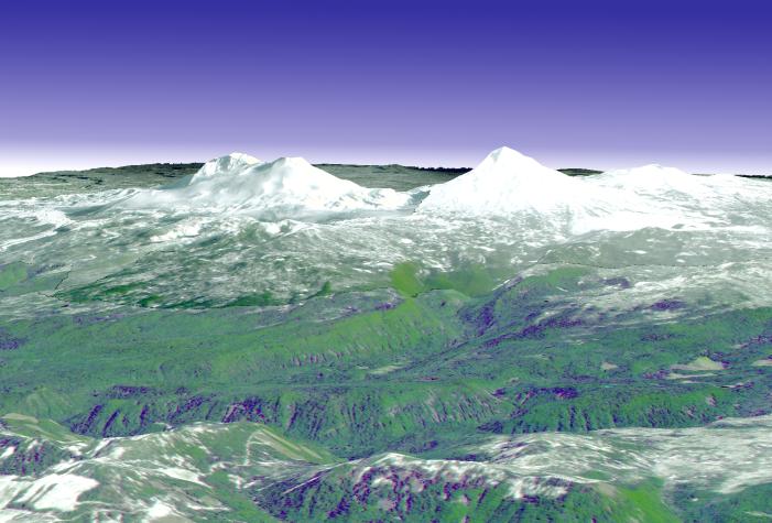
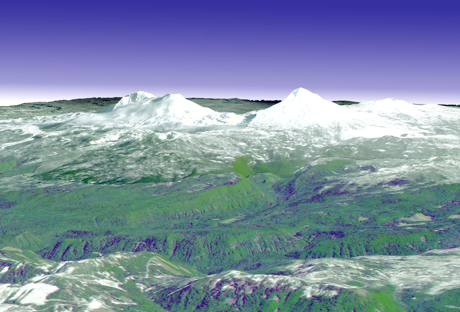
The ground near one of the long-dormant Three Sisters volcanoes in the Cascade Mountains of west-central Oregon has risen approximately 10centimeters in a 10-by-20-km parcel since 1996, meaning that magma or underground lava is slowly flowing into the area, according to a research team from the U.S. Geological Survey. The Three Sisters area -- which contains five volcanoes -- is only about 170 miles from Mount St. Helens, which erupted in 1980. Both are part of the Cascades Range, a line of 27volcanoes stretching from British Columbia in Canada to northern California. This perspective view was created by draping a simulated natural color ASTER image over digital topography from the U.S. Geological Survey National Elevation Dataset.
This image was acquired on May 28, 2000 by the Advanced Spaceborne Thermal Emission and Reflection Radiometer (ASTER) on NASA's Terra satellite. With its 14 spectral bands from the visible to the thermal infrared wavelength region, and its high spatial resolution of 15 to 90 meters (about 50 to 300 feet), ASTER will image Earth for the next 6 years to map and monitor the changing surface of our planet.
ASTER is one of five Earth-observing instruments launched December 18, 1999, on NASA's Terra satellite. The instrument was built by Japan's Ministry of Economy, Trade and Industry. A joint U.S./Japan science team is responsible for validation and calibration of the instrument and the data products. Dr. Anne Kahle at NASA's Jet Propulsion Laboratory, Pasadena, California, is the U.S. Science team leader; Bjorn Eng of JPL is the project manager. ASTER is the only high resolution imaging sensor on Terra. The Terra mission is part of NASA's Earth Science Enterprise, along-term research and technology program designed to examine Earth's land, oceans, atmosphere, ice and life as a total integrated system.
The broad spectral coverage and high spectral resolution of ASTER will provide scientists in numerous disciplines with critical information for surface mapping, and monitoring dynamic conditions and temporal change. Example applications are: monitoring glacial advances and retreats; monitoring potentially active volcanoes; identifying crop stress; determining cloud morphology and physical properties; wetlands evaluation; thermal pollution monitoring; coral reef degradation; surface temperature mapping of soils and geology; and measuring surface heat balance.
Size: 20 x 25 km (12 x 15 miles)
Location: 44.1 deg. North lat., 122.1 deg. West long.
Orientation: View towards Southeast
Image Data: ASTER bands 1,2, and 3.
Original Data Resolution: 15 m
Date Acquired: Various