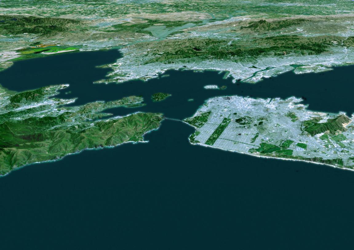
The cities of San Francisco and the East Bay are highlighted in this computer-generated perspective viewed from west of the Golden Gate. San Francisco occupies the peninsula jutting into the picture from the right. Golden Gate Park is the long rectangle near its left end and the Presidiois the green area at its tip, from which Golden Gate Bridge crosses to Marin. Treasure Island is the bright spot above San Francisco and Alcatraz Island is the small smudge below and to the left. Across the bay from San Francisco lie Berkeley (left) and Oakland (right). Mount Diablo, a landmark visible for many miles, rises in the distance at the upper right.
This three-dimensional perspective view was generated using topographic data from the Shuttle Radar Topography Mission (SRTM) and an enhanced false-color Landsat 5 satellite image. Colors are from Landsat bands 3, 2, and 1 as red, green and blue, respectively. Topographic expression is exaggerated two times.
Landsat has been providing visible and infrared views of the Earth since 1972. SRTM elevation data matches the 30-meter (98-foot) resolution of most Landsat images and will substantially help in analyzing the large and growing Landsat image archive.
The Landsat Thematic Mapper image used here came from an on-line mosaic of Landsat images for the continental United States (http://mapus.jpl.nasa.gov), a part of NASA's Digital Earth effort.
Elevation data used in this image was acquired by the Shuttle Radar Topography Mission (SRTM) aboard the Space Shuttle Endeavour, launched on Feb. 11, 2000. SRTM used the same radar instrument that comprised the Spaceborne Imaging Radar-C/X-Band Synthetic Aperture Radar (SIR-C/X-SAR) that flew twice on the Space Shuttle Endeavour in 1994. SRTM was designed to collect 3-D measurements of the Earth's surface. To collect the 3-D data, engineers added a 60-meter (approximately 200-foot) mast, installed additional C-band and X-band antennas, and improved tracking and navigation devices. The mission is a cooperative project between NASA, the National Imagery and Mapping Agency (NIMA) of the U.S. Department of Defense and the German and Italian space agencies. It is managed by NASA's Jet Propulsion Laboratory, Pasadena, Calif., for NASA's Earth Science Enterprise, Washington, DC.
Size: scale varies in this perspective image
Location: 37.5 deg. North lat., 122.3 deg. West lon.
Orientation: looking west
Image Data: Landsat Bands 3, 2, 1 as red, green, blue, respectively
Original Data Resolution: SRTM 1 arcsecond (30 meters or 98 feet), Thematic Mapper 1 arcsecond (30 meters or 98 feet)
Date Acquired: February 2000 (SRTM)
