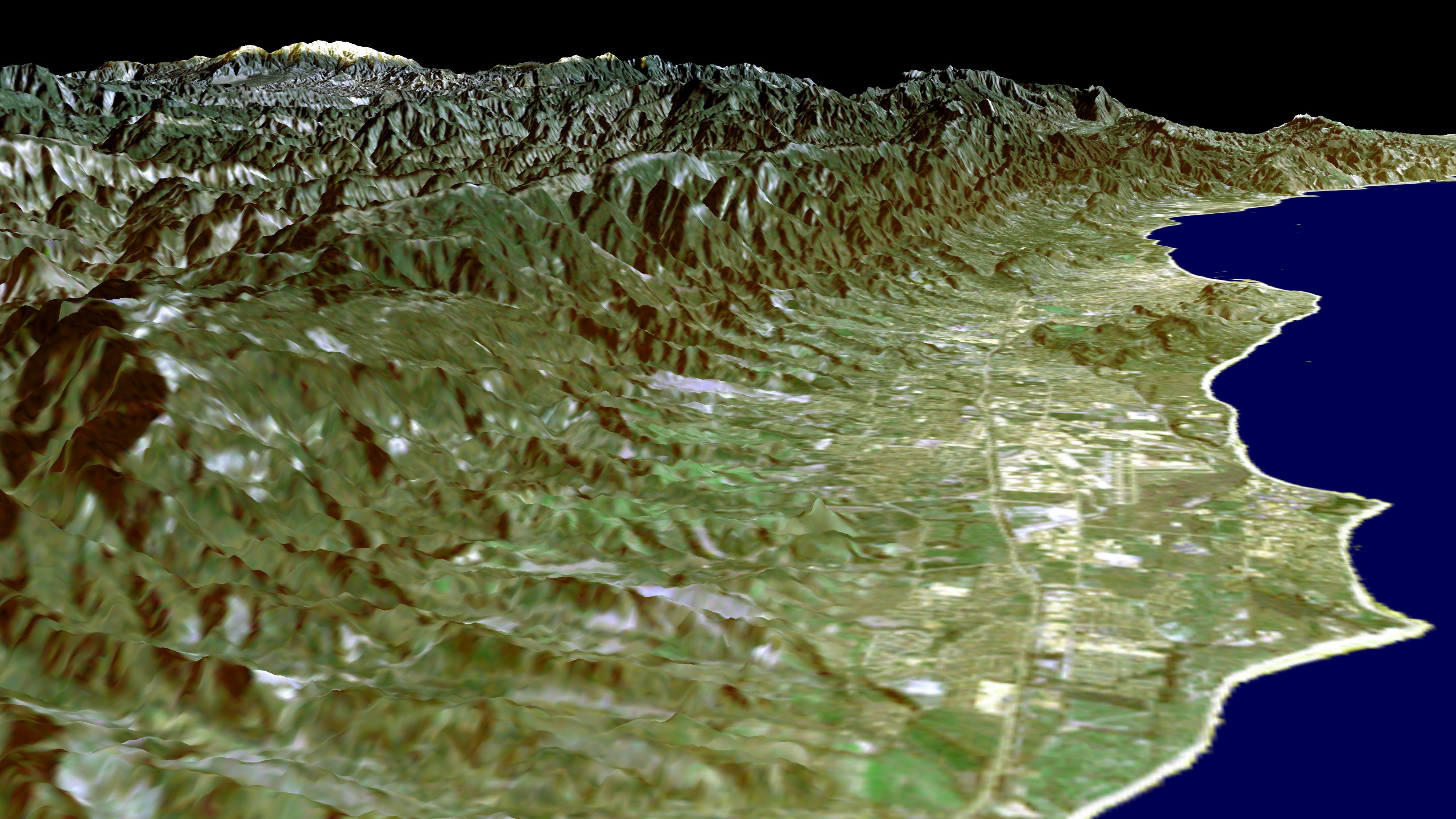
This image of the Santa Barbara, California, region provides a beautiful snapshot of the area's rugged mountains and long and varied coastline. Generated using data acquired from the Shuttle Radar Topography Mission (SRTM) and an enhanced Landsat image this is a perspective view toward the northeast, from the Goleta Valley in the foreground to a snow-capped Mount Abel (elevation 2,526 m or 8,286 feet) along the skyline at the left. On a clear day, a pilot might see a similar view shortly before touching down on the east-west runway of the Santa Barbara Airport, seen just to the left of the coastline near the center of image. This area is one of the few places along the U.S. West Coast where because of a south-facing beach, fall and winter sunrises occur over the ocean.
Landsat has been providing visible and infrared views of the Earth since 1972. SRTM elevation data match the 30-meter (98-foot) resolution of most Landsat images and will substantially help in analyses of the large and growing Landsat image archive. For visualization purposes, topographic heights displayed in this image are exaggerated two times. Colors approximate natural colors.
The elevation data used in this image was acquired by SRTM aboard Space Shuttle Endeavour, launched on February 11, 2000. SRTM used the same radar instrument that comprised the Spaceborne Imaging Radar-C/X-Band Synthetic Aperture Radar (SIR-C/X-SAR) that flew twice on Endeavour in 1994. SRTM was designed to collect three-dimensional measurements of Earth's land surface. To collect the 3-D SRTM data, engineers added a mast 60 meters (about 200-feet) long, installed additional C-band and X-band antennas, and improved tracking and navigation devices. The mission is a cooperative project between the NASA, the National Imagery and Mapping Agency (NIMA) of the U.S. Department of Defense, and the German and Italian space agencies. It is managed by NASA's Jet Propulsion Laboratory, Pasadena, Calif, for NASA's Earth Science Enterprise, Washington, D.C. JPL is a division of the California Institute of Technology in Pasadena.
Location: 34.5 deg. North lat., 119.75 deg. West lon.
View: Northeast
Scale: Scale Varies in this Perspective
Date Acquired: February 16, 2000 SRTM, December 14, 1984 Landsat
