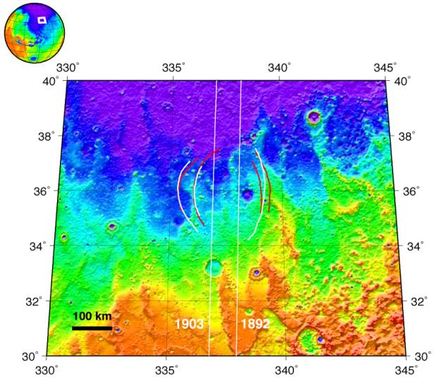
This topographic map, based on data from the Mars Orbiter Laser Altimeter, shows the ground track of the 1,892nd and the 1,903rd orbits of Mars Express and the arc structures detected by that orbiter's Mars Advanced Radar for Subsurface and Ionospheric Sounding (MARSIS). The arc structures are interpreted to be part of a buried impact basin about 250 kilometers (155 miles) in diameter.
The topographic relief represented in the image is 1 kilometer (0.6 mile), from low (purple) to high (red). The projected arcs are shown in red for orbit 1892 and white for orbit 1903. There is no obvious feature in the surface topography that corresponds to the buried feature identified with MARSIS data.
NASA and the Italian Space Agency jointly funded the MARSIS instrument on the European Space Agency's Mars Express orbiter. The Mars Orbiter Laser Altimeter is an instrument on NASA's Mars Global Surveyor orbiter.