- Original Caption Released with Image:
-
Click on an individual image for full resolution image
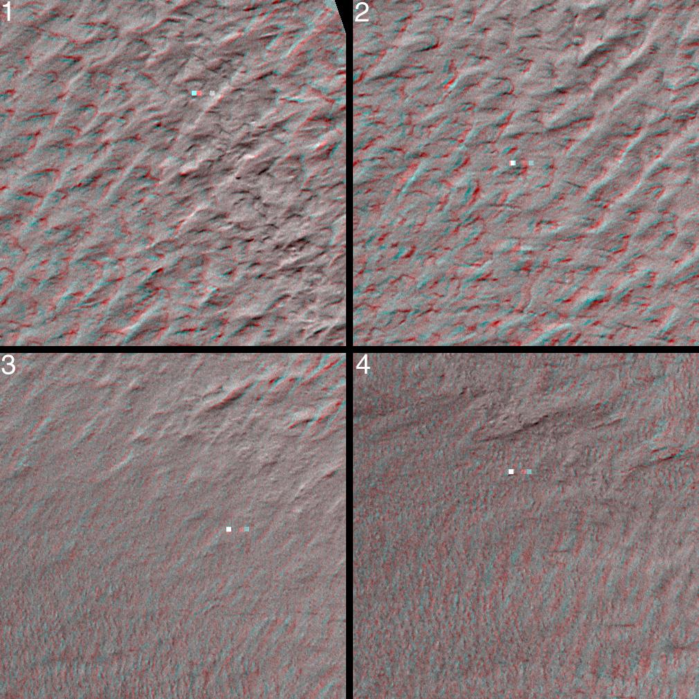
The data acquired by the Mars Global Surveyor (MGS) Mars Orbiter Camera (MOC) during the period between September 1999 and February 2000--now available for viewing in the MGS MOC GALLERY--include hundreds of pictures taken in support of the Mars Polar Lander mission before and after the attempted landing. Repeated efforts to find the lost lander during December 1999 and January - February 2000 resulted in several overlapping pictures taken from different angles as the spacecraft was pointed off its usual nadir--looking straight down--imaging position. Pictures such as these are perfect for 3-D, or, stereo, viewing. The context image on the right shows, at 20 meters (66 ft) per pixel, the mosaic of MOC images obtained to search for the lost lander. The four small white boxes show the locations of 3D views in the picture on the left. To view these in stereo, you need red-blue 3D glasses (red filter over left eye, blue over right). Each stereo (3-D) image covers an area approximately 750 by 750 meters (about 1/2 a mile on a side). The terrain appears to be rugged, but the cause of this relief is unknown. Perhaps wind and frost have shaped this landscape. The Mars Polar Lander was lost during descent on December 3, 1999. Its location was not found in the MOC images (finding the lander would have been very difficult, because it is so small--smaller than a Volkswagen "Beetle"--and the camera was not really designed to see things that small; see Mars Polar Lander: The Search Begins). These images are located near 76.3°S, 195.0°W. North is toward the top and illumination is from the upper left. For scale, two small squares in each 3-D image are 10 m on a side, 40 m apart horizontally, and 10 m apart vertically (10 m = 10.9 yards; 40 m = 47.3 yards).
- Image Credit:
-
NASA/JPL/MSSS
Image Addition Date: -
2000-10-16
|
