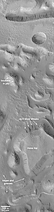
Release image with labels | 
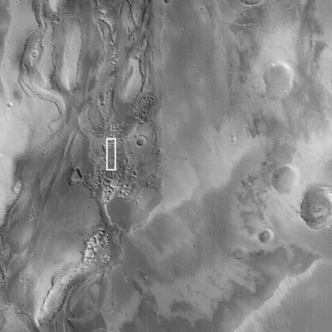
Context Image |
When it was proposed to NASA in 1985, one of the goals of the Mars Global Surveyor (MGS) Mars Orbiter Camera (MOC) experiment was to take pictures with high enough resolution to be able to see large boulders on the planet's surface. For large martian outflow channels -- believed by some to have been carved by giant floods several billion years ago -- seeing boulders and measuring their size and distribution in the channels can tell geologists something about the nature of the flood--for example, how fast the water was moving, and, in some cases, how deep it was.
But Mars doesn't always cooperate.
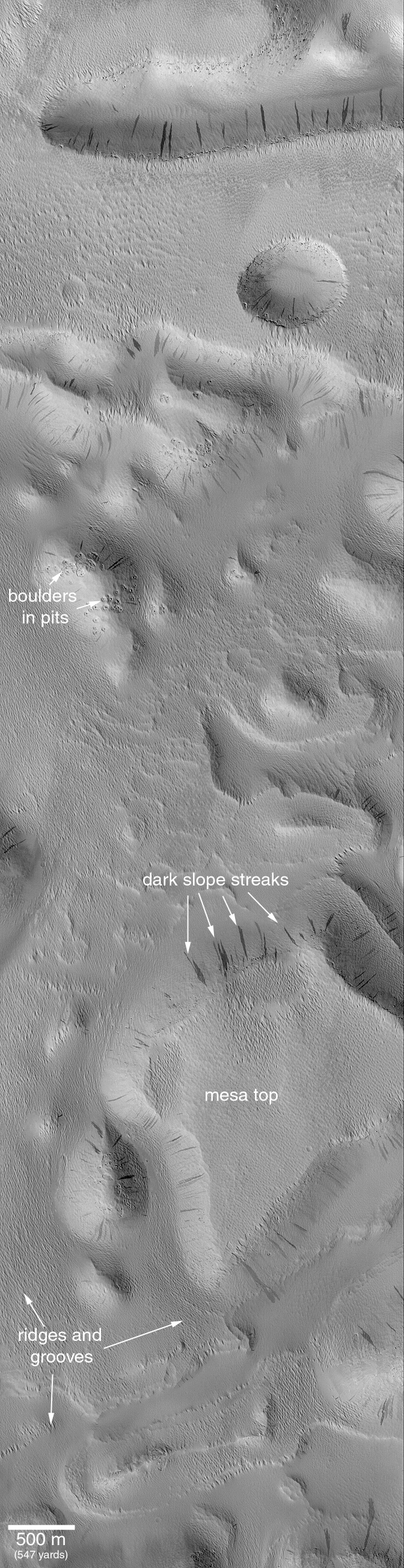
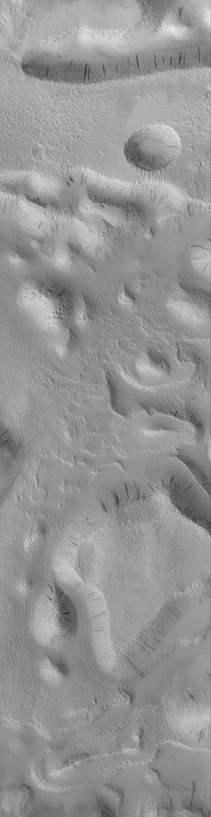
The white box in the context image on the right shows the location of the high resolution MOC image on the left. The white box in the context frame is located among buttes and mesas within Mangala Valles, one of the large martian channels thought to have been carved by floods long ago. The high resolution view, however, offers no insight into the processes that formed Mangala Valles. Instead, the entire surface -- mesa tops, buttes, and channel floor -- are all covered-up with a thick blanket of wind-eroded, ridged and grooved material. Some of the buttes and mesas have boulders on their surfaces, and wind has hollowed-out circular depressions around these boulders. But the boulders in this case probably have nothing to do with the floods that might have formed Mangala Valles -- they are boulders exposed in the bedrock contained beneath the ridged and grooved mantle that covers each butte and mesa. The dark streaks on slopes in this image are places where dry accumulations of dust have slid downhill, much like a snow avalanche. Similar streaks have been seen elsewhere on the dusty surfaces of Mars, and some have been found to change over time. For example, see Recent Movements: New Landslides in Less than 1 Martian year.
This picture is located near 8.7°S, 151.2°W; it covers an area 3 km (1.9 mi) by 11.7 km (7.3 mi). North is toward the upper right, and illumination is from the upper left. This is a subframe of MOC image M11-01809, acquired January 13, 2000. To see what the raw MOC image data look like, visit the newest data releases (for Mission Subphases M07 - M12, covering September 1999 through February 2000) in the MOC GALLERY.
