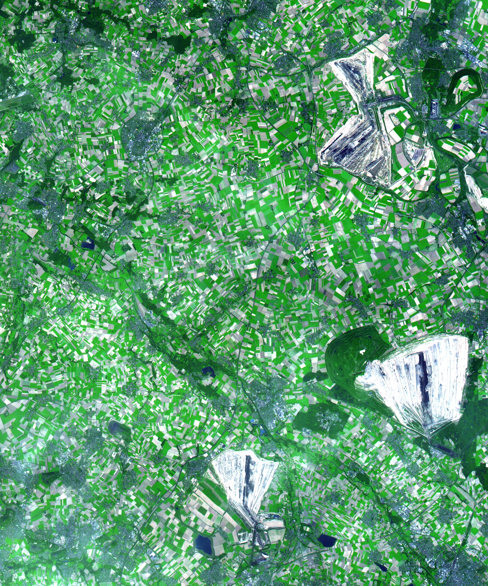
This simulated natural color ASTER image in the German state of North Rhine Westphalia covers an area of 30 by 36 km, and was acquired on August 26, 2000. On the right side of the image are 3 enormous opencast coalmines. The Hambach opencast coal mine has recently been brought to full output capacity through the addition of the No. 293 giant bucket wheel excavator. This is the largest machine in the world; it is twice as long as a soccer field and as tall as a building with 30 floors. To uncover the 2.4 billion tons of brown coal (lignite) found at Hambach, five years were required to remove a 200-m-thick layer of waste sand and to redeposit it off site. The mine currently yields 30 million tons of lignite annually, with annual capacity scheduled to increase to 40 million tons in coming years.
The image is centered at 51 degrees north latitude, 6.4 degrees east longitude.
Advanced Spaceborne Thermal Emission and Reflection Radiometer (ASTER) is one of five Earth-observing instruments launched December 18, 1999, on NASA's Terra satellite. The instrument was built by Japan's Ministry of International Trade and Industry. A joint U.S./Japan science team is responsible for validation and calibration of the instrument and the data products. Dr. Anne Kahle at NASA's Jet Propulsion Laboratory, Pasadena, California, is the U.S. science team leader; Moshe Pniel of JPL is the project manager. ASTER is the only high-resolution imaging sensor on Terra. The primary goal of the ASTER mission is to obtain high-resolution image data in 14 channels over the entire land surface, as well as black and white stereo images. With revisit time of between 4 and 16 days, ASTER will provide the capability for repeat coverage of changing areas on Earth's surface.
The broad spectral coverage and high spectral resolution of ASTER will provide scientists in numerous disciplines with critical information for surface mapping and monitoring dynamic conditions and temporal change. Examples of applications include monitoring glacial advances and retreats, potentially active volcanoes, thermal pollution, and coral reef degradation; identifying crop stress; determining cloud morphology and physical properties; evaluating wetlands; mapping surface temperature of soils and geology; and measuring surface heat balance.
