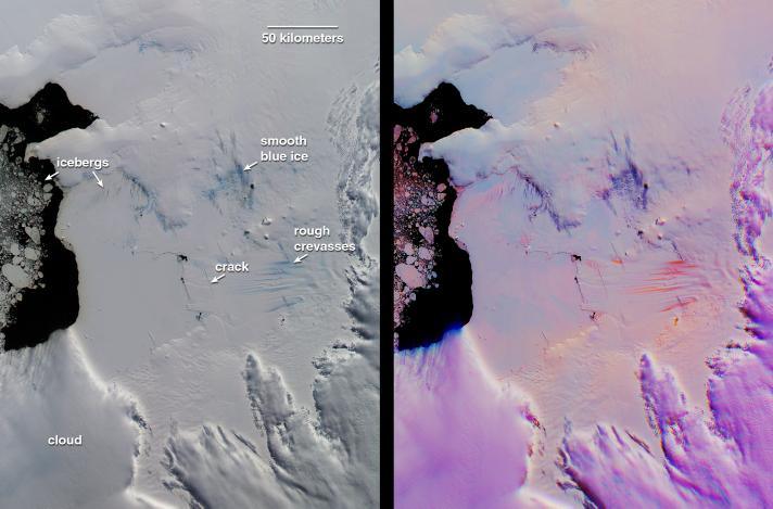
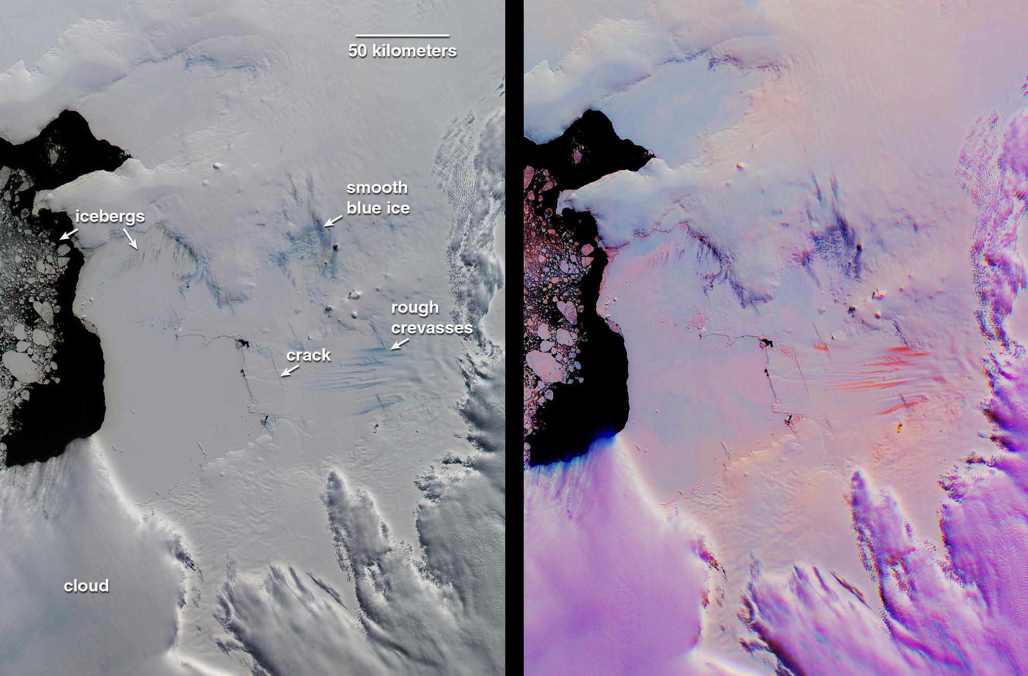
This pair of MISR images of the Pine Island Glacier in western Antarctica was acquired on December 12, 2000 during Terra orbit 5246. At left is a conventional, true-color image from the downward-looking (nadir) camera. The false-color image at right is a composite of red band data taken by the MISR forward 60-degree, nadir, and aftward 60-degree cameras, displayed in red, green, and blue colors, respectively. Color variations in the left (true-color) image highlight spectral differences. In the multi-angle composite, on the other hand, color variations act as a proxy for differences in the angular reflectance properties of the scene. In this representation, clouds show up as light purple. Blue to orange gradations on the surface indicate a transition in ice texture from smooth to rough. For example, the bright orange "carrot-like" features are rough crevasses on the glacier's tongue. In the conventional nadir view, the blue ice labeled "rough crevasses" and "smooth blue ice" exhibit similar coloration, but the multi-angle composite reveals their different textures, with the smoother ice appearing dark purple instead of orange. This could be an indicator of different mechanisms by which this ice is exposed. The multi-angle view also reveals subtle roughness variations on the frozen sea ice between the glacier and the open water in Pine Island Bay.
To the left of the "icebergs" label are chunks of floating ice. Additionally, smaller icebergs embedded in the frozen sea ice are visible below and to the right of the label. These small icebergs are associated with dark streaks. Analysis of the illumination geometry suggests that these streaks are surface features, not shadows. Wind-driven motion and thinning of the sea ice in the vicinity of the icebergs is one possible explanation.
Recently, Robert Bindschadler, a glaciologist at the NASA Goddard Space Flight Center discovered in Landsat 7 imagery a newly-formed crack traversing the Pine Island Glacier. This crack is visible as an off-vertical dark line in the MISR nadir view. In the multi-angle composite, the crack and other stress fractures show up very clearly in bright orange. Radar observations of Pine Island Glacier in the 1990's showed the glacier to be shrinking, and the newly discovered crack is expected to eventually lead to the calving of a major iceberg.
MISR was built and is managed by NASA's Jet Propulsion Laboratory, Pasadena, CA, for NASA's Office of Earth Science, Washington, DC. The Terra satellite is managed by NASA's Goddard Space Flight Center, Greenbelt, MD. JPL is a division of the California Institute of Technology.