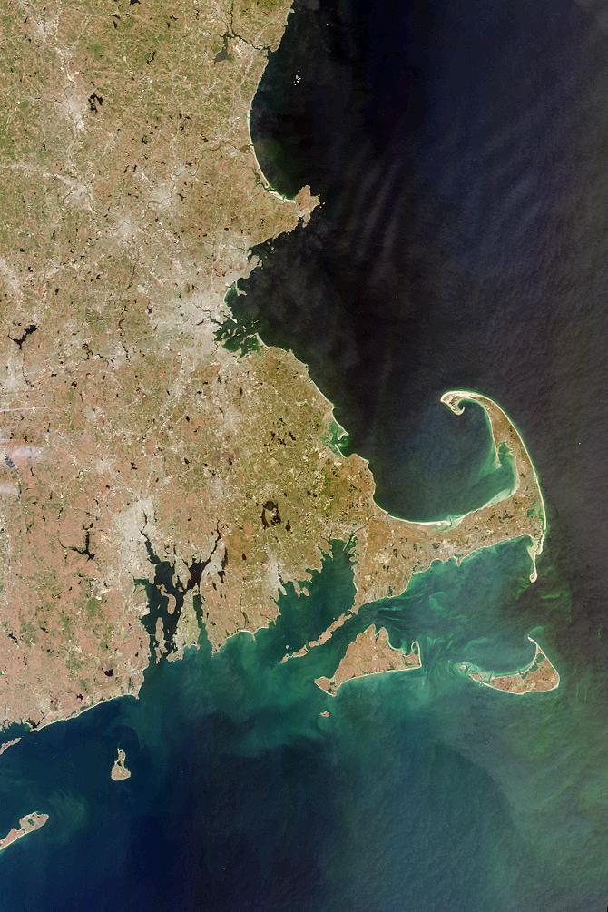
Each year in late November the United States observes the Thanksgiving holiday, commemorating the harvest festival celebrated by the Plymouth colonists and the Native Americans who helped them survive the devastating winter of 1620. Plymouth, Massachusetts, where the Mayflower Pilgrims landed, is located on the west side of Cape Cod Bay, shown in this MISR vertical-viewing (nadir) camera image. This nearly cloud-free picture was acquired on April 13, 2000 during Terra orbit 1708.
South of the distinctively-shaped Cape Cod are Nantucket Island and Martha's Vineyard. Further west is Block Island, south of Narragansett Bay, Rhode Island. Montauk Point on the eastern tip of Long Island, New York, is visible at the lower left. On the mainland, Providence and Boston appear as gray patches. Jutting out from the Massachusetts coastline, northeast of Boston, is Cape Ann, location of the city of Gloucester, which was settled soon after the Pilgrim's arrival in Plymouth. Gloucester is the oldest fishing port in the eastern United States.
MISR was built and is managed by NASA's Jet Propulsion Laboratory, Pasadena, CA, for NASA's Office of Earth Science, Washington, DC. The Terra satellite is managed by NASA's Goddard Space Flight Center, Greenbelt, MD. JPL is a division of the California Institute of Technology.
