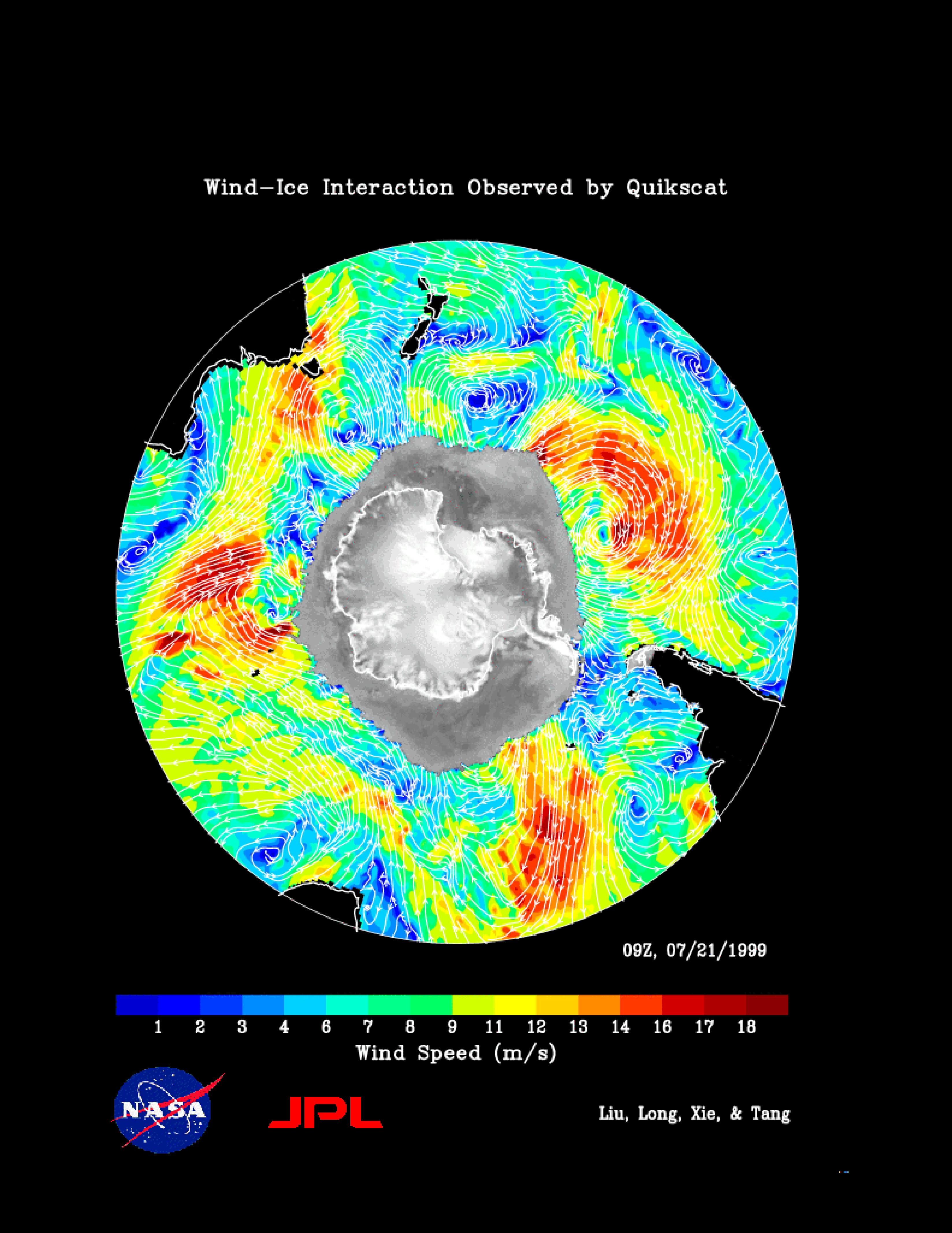
The figure demonstrates of the capability of the SeaWinds instrument on NASA's QuikScat satellite in monitoring both sea ice and ocean surface wind, thus helping to further our knowledge in wind-ice interaction and its effect on climate change. The gray-scale image of normalized radar back scatter shows various kinds of ice in Antarctica. The land mass is outlined in black. The gray area outside the land mass is occupied by sea ice. Outside of the ice, white streamlines representing wind direction are overlaid onto the color image of wind speed distribution. The map (including both ice and wind) is produced from one day, July 21, 1999, of QuikScat interim observations.
With its all-weather observing capability, SeaWinds provides continuous monitoring of ice edge and tracking of icebergs, and describes the morphology of both glacier ice and sea ice. Since the start of its ocean observing mode, SeaWinds has already helped the National Snow and Ice Data Center track an iceberg broken off from Antarctica.
NASA's Earth Science Enterprise is a long-term research and technology program designed to examine Earth's land, oceans, atmosphere, ice and life as a total integrated system. JPL is a division of the California Institute of Technology, Pasadena, CA.
