- Original Caption Released with Image:
-
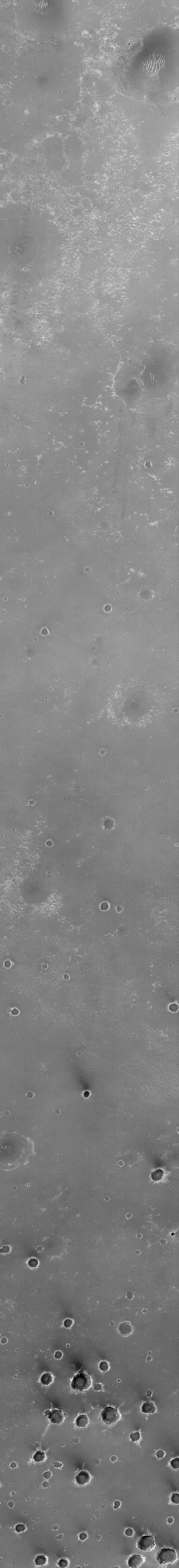
This Mars Global Surveyor (MGS) Mars Orbiter Camera (MOC) image shows a dark, relatively smooth plain in the central Terra Meridiani region of Mars. The larger circular features in the upper three-quarters of the image are thought to be the locations of buried craters formed by meteorite impact. The cluster of smaller circular features in the bottom quarter of the scene represent a field of craters formed either by simultaneous impact of many meteorites, or there-impact of material thrown from a much, much larger nearby crater as it formed. The dark material covering these plains includes an abundance of the iron oxide mineral, hematite, that was detected by the MGS Thermal Emission Spectrometer (TES). During late 1999, the "hematite region," as it came to be called, emerged along with the Libya Montes as one of the top two choices of landing sites for the now-canceled Mars Surveyor 2001 lander. This image, illuminated by sunlight from the left, covers an area 3 kilometers (1.9 miles) wide and 19 kilometers (11.8 miles) long. The scene is located near 2.2°S, 3.7°W and was acquired on August 19, 1999.
- Image Credit:
-
NASA/JPL/MSSS
Image Addition Date: -
2000-05-22
|
